
The table on this page first appeared in an earlier iteration of the website of the Barrington Preservation Society, a 501(c)(3) nonprofit volunteer historical organization in Barrington, Rhode Island. I assembled this dataset of digital maps and created this tabular webpage in 2015, originally for my own use and the use of others researching the history of the Barrington, Rhode Island, area.
Click thumbnail (column 3) to open Barrington-area detail on separate page. Links in column 4 are deep links to individual collection records at the named repositories, usually with full-resolution originals.
| Date | Description | Thumbnail-Detail | Original (Link) |
|---|---|---|---|
| 1634 | “The South part of New-England, as it is Planted this yeare, 1634.” William Wood, London. Shows location of the “pocanokick Sagamore.” | 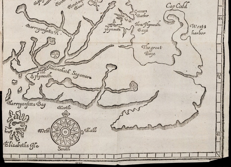 | Yale: Bienecke Library |
| 1677 | “A Map of New-England by John Foster, Boston.” Seaconk and Mount Hope are labeled. | 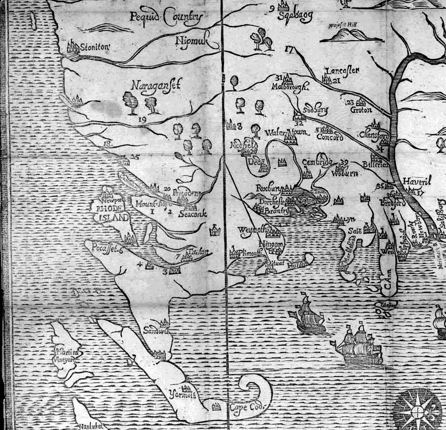 | Massachusetts Historical Society |
| 1685 | “Map of New Netherland and New England, and also parts of Virginia,” by Nicholas Visscher. | 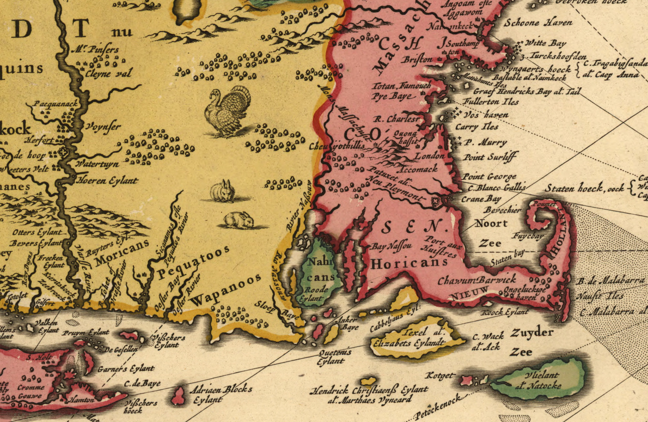 | Library of Congress |
| 1720 | “Partie de la Novvelle Angleterre,” annotated manuscript map. Mistakenly shows the “Province de Rhode Islan” including all of Cape Cod. | 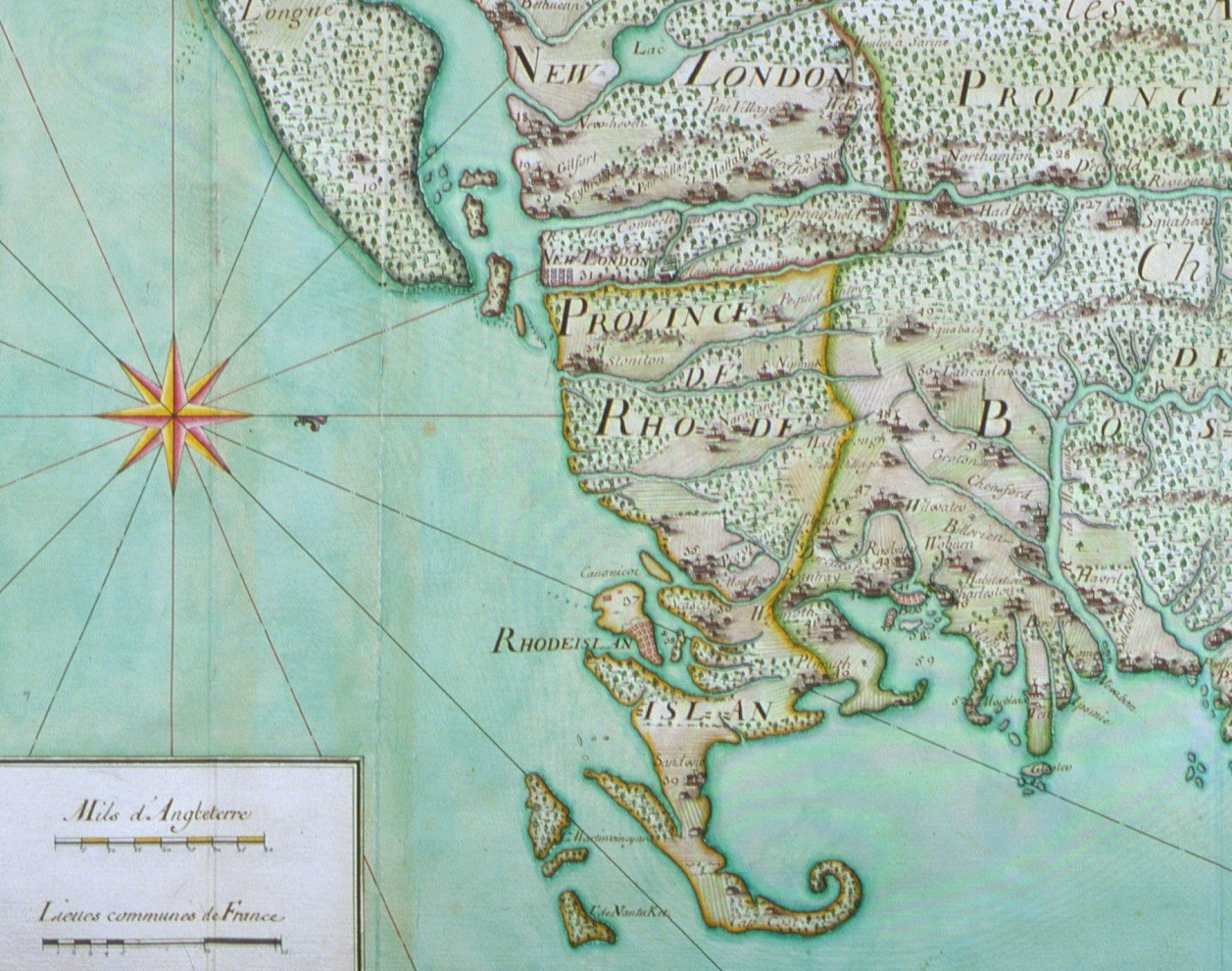 | Newberry Library |
| 1741 | Boundary Commission Map of the Massachusetts-Rhode Island border shift (1845 lithograph copy, London). This shift transferred Barrington-Warren-Bristol from Massachusetts to Rhode Island. | 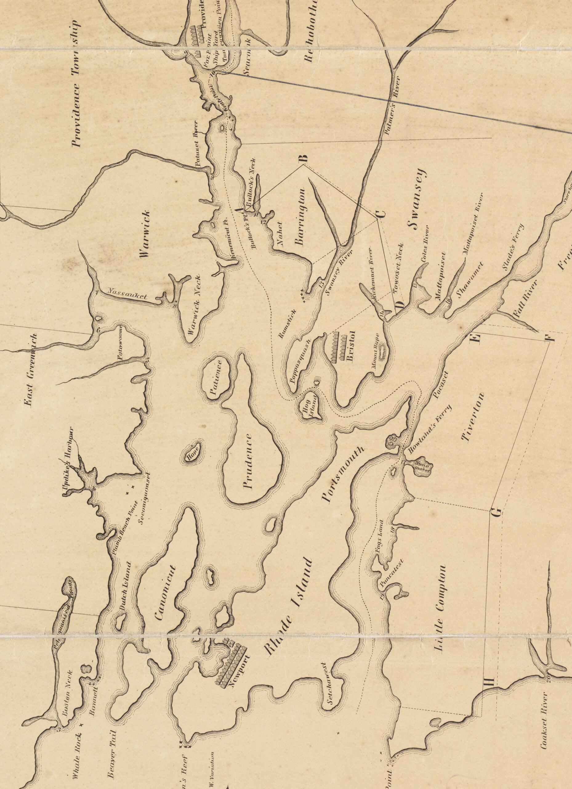 | Boston Public Library, Leventhal Map Center |
| 1758 | “Map of the Colonies of Connecticut and Rhode Island,” Thomas Kitchin, London. Shows “Barrington” in Massachusetts! | 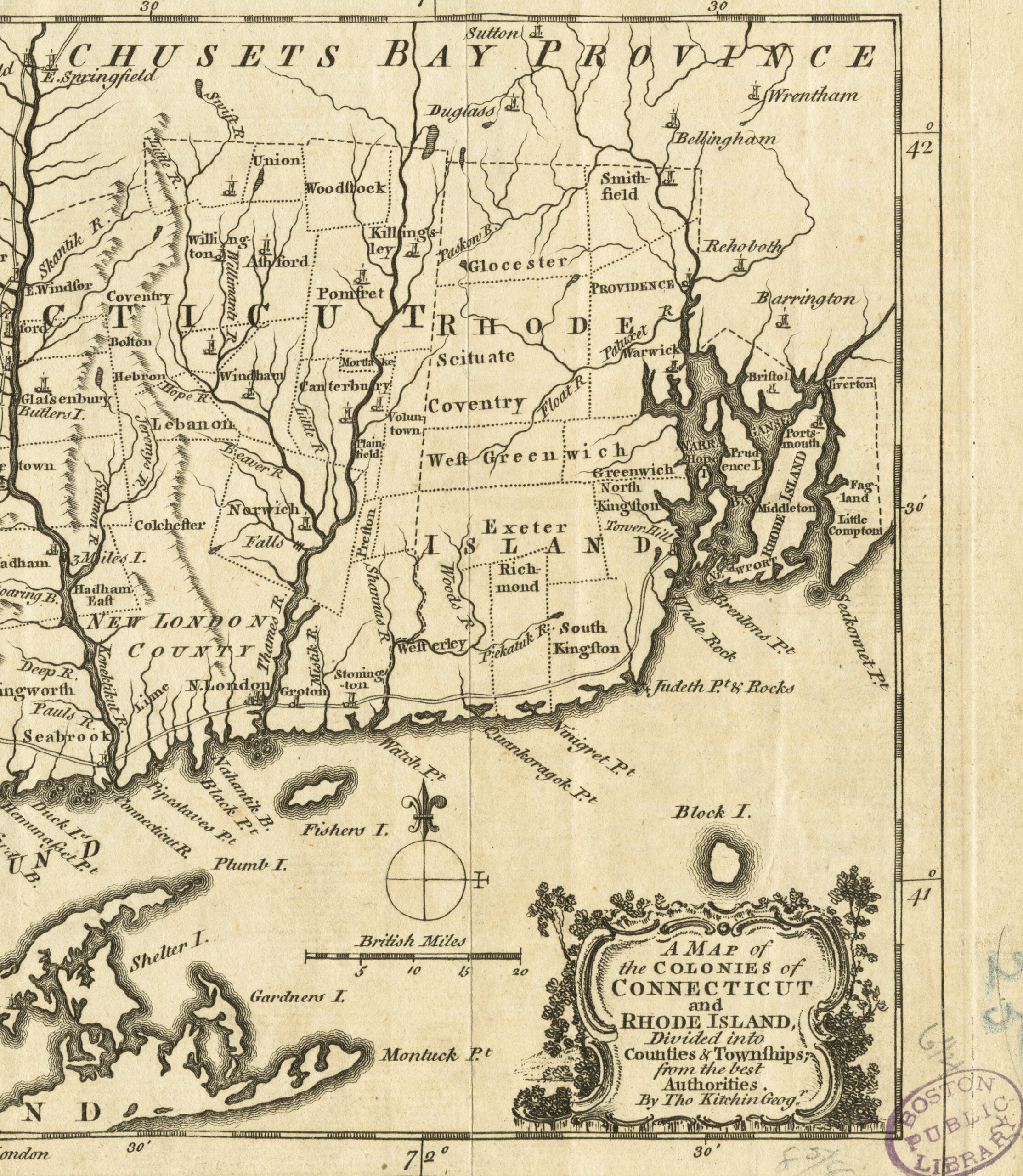 | Boston Public Library, Leventhal Map Center |
| 1768 | Allin family farm (West Barrington), drawn by Thomas Allin between November 1768 and March 1769. | 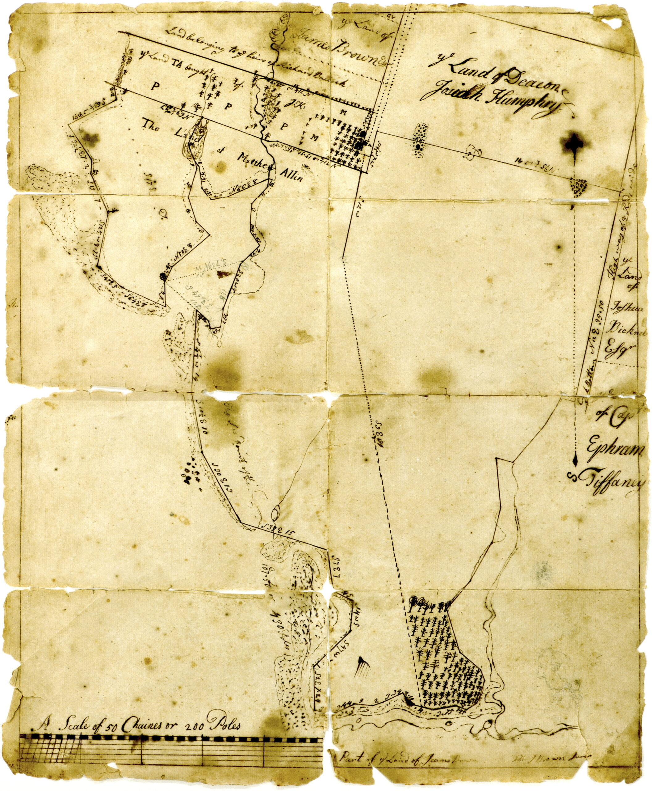 | Privately held. Digital image granted to BPS. |
| 1771 | “Part of Col. Samuel Allens Home Lot: March the 12:1771” (Barrington Village). Ink and watercolor plat by Thomas Allin. | 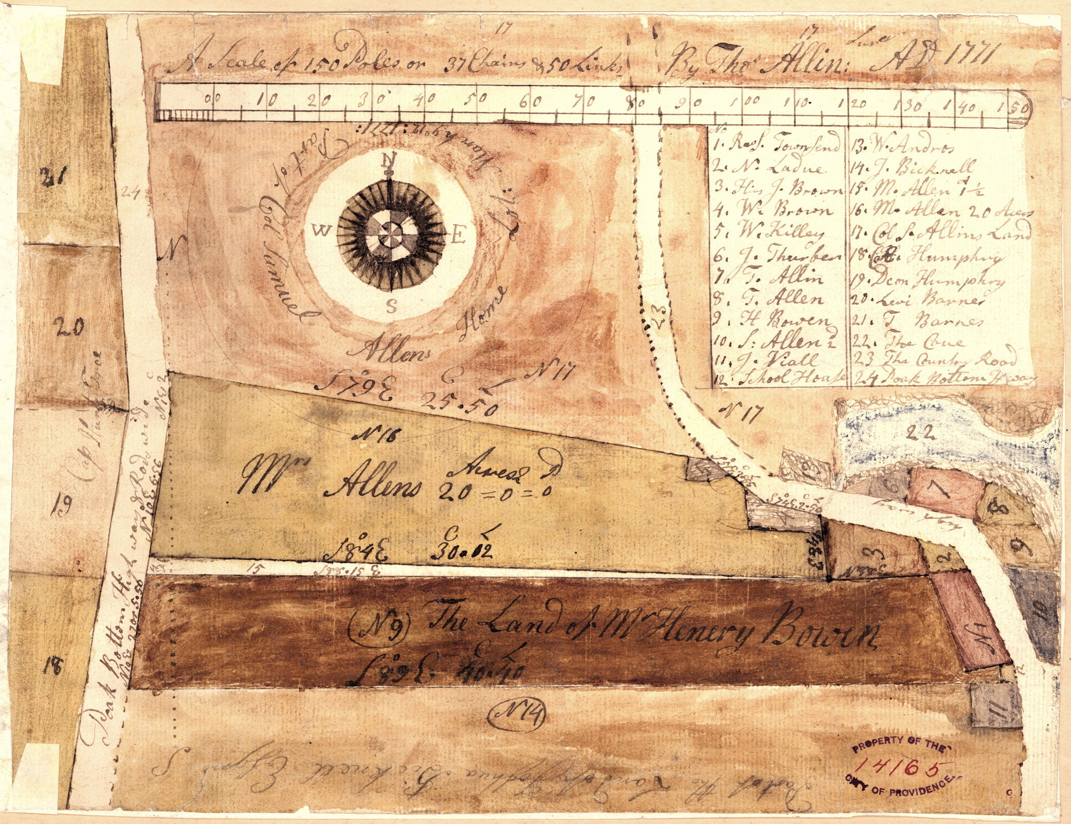 | R.I.H.S., MSS 214, “Providence Town Papers,” vol. 33 (Henry Bowen papers), item 14165. |
| 1775 | “A Plan of the Sea Coast from Boston Bay to the Light House near Rhode Island,” manuscript map. | 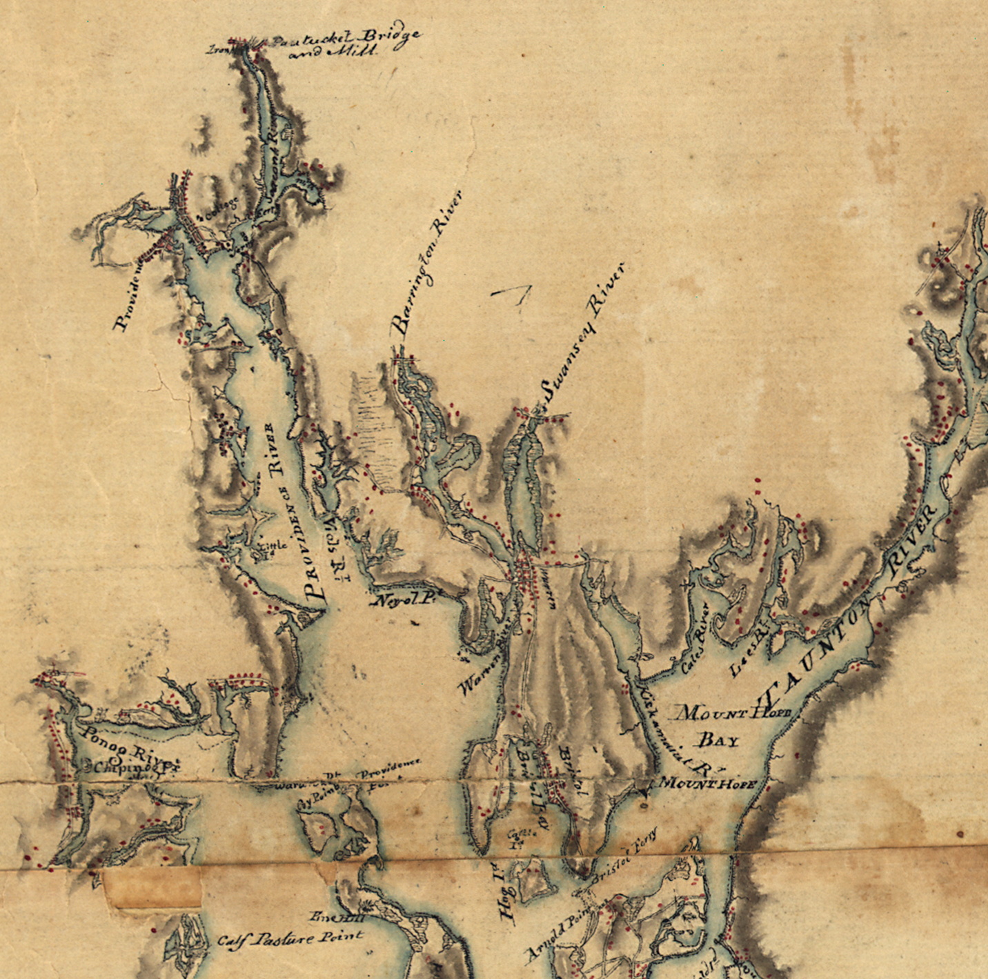 | Library of Congress |
| 1775 | “A New and Accurate Map of the Present Seat of War in North America” (actually southern New England). | 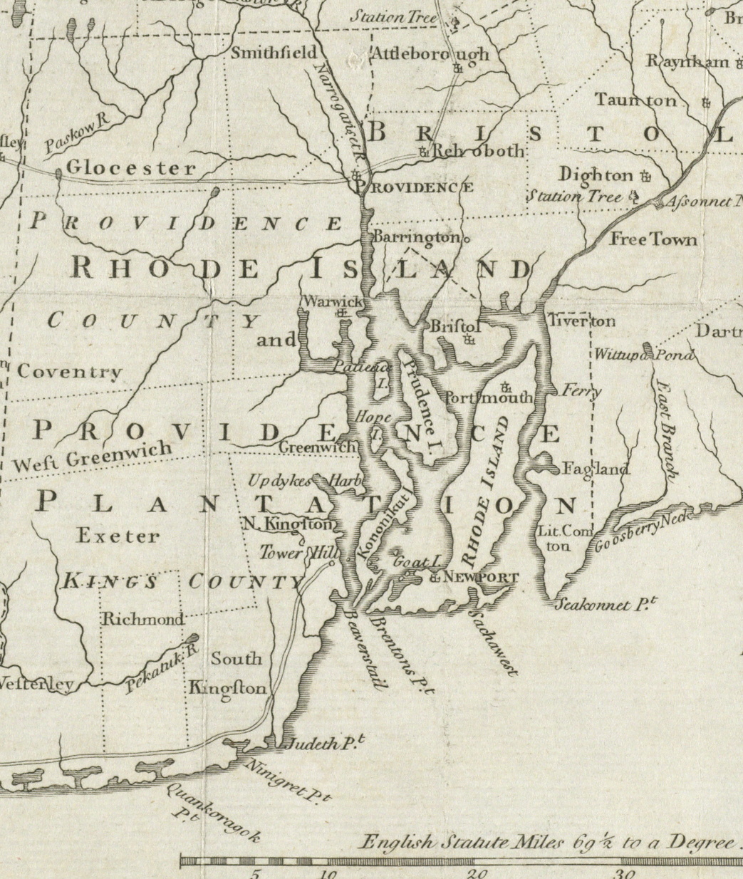 | Boston Public Library, Leventhal Map Center |
| 1775 | “The Seat of War in New England by an American Volunteer.” Has the name “Nakil” in Italic type in location of Barrington. | 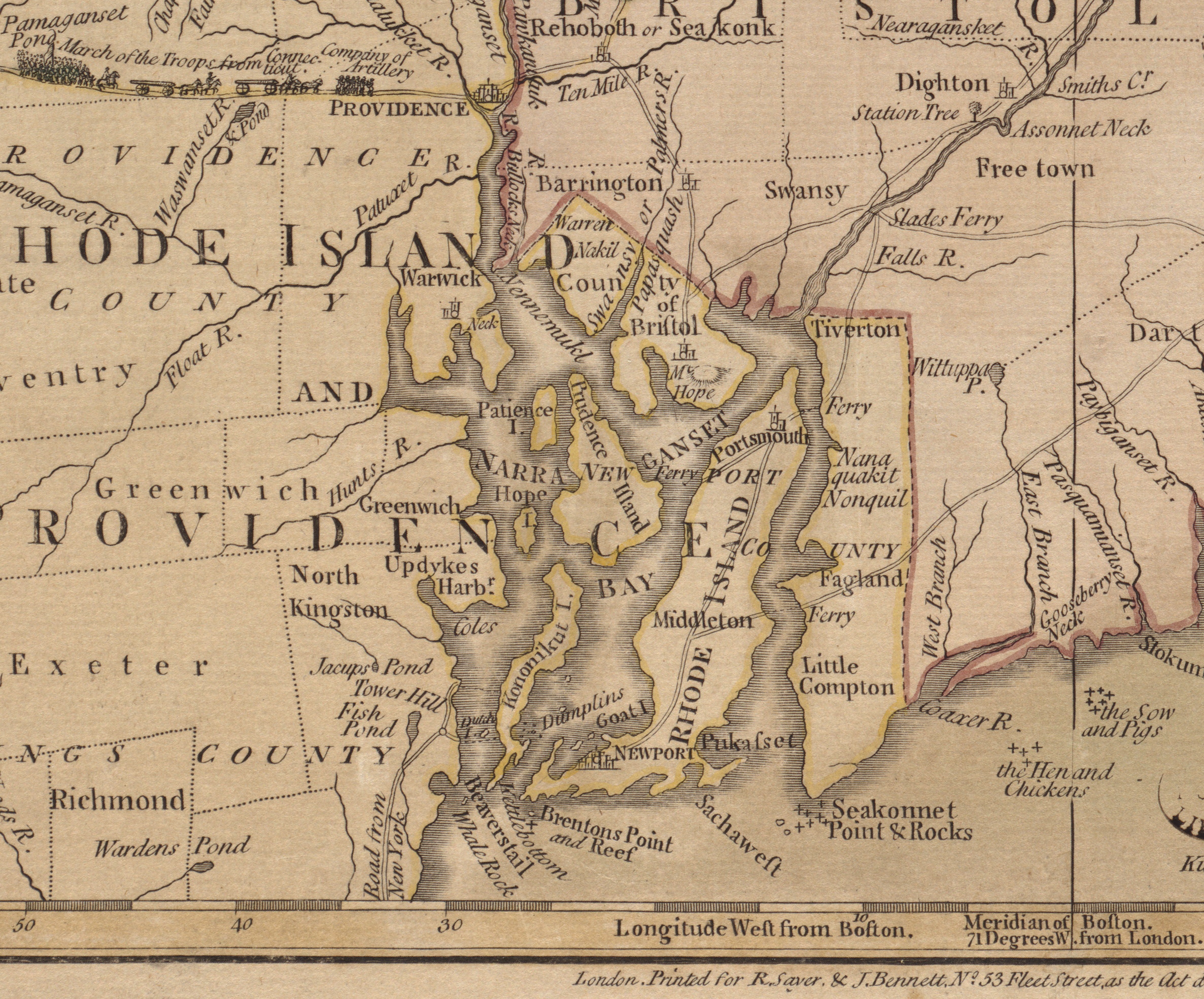 | Boston Public Library, Leventhal Map Center |
| 1776 | “Chart of the Harbour of Rhode Island and Narragansett Bay Published at the Request of the Right Honourable Lord Viscount Howe” by J. F. W. Des Barres. Shows location of houses and cultivated fields. | 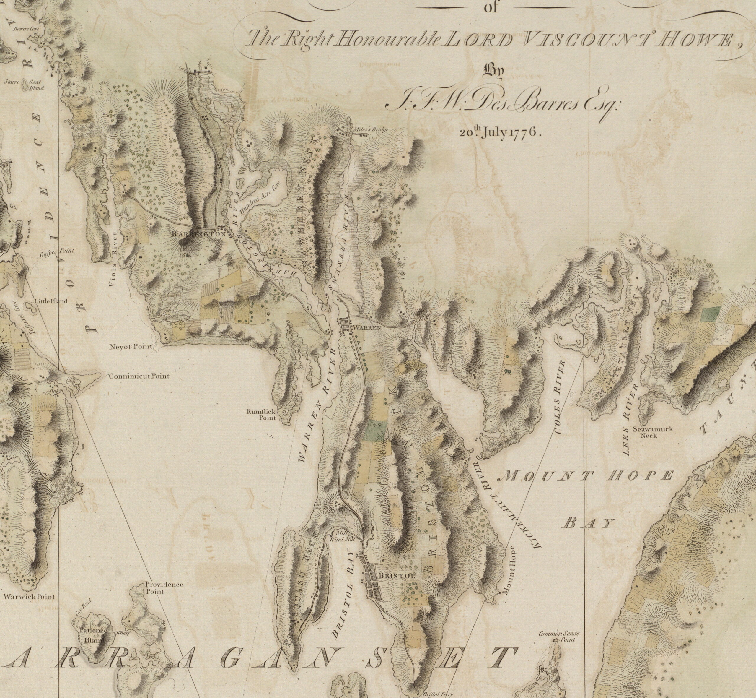 | Boston Public Library, Leventhal Map Center |
| 1777 | “A Map of the bay of Narragansett with the islands therein.” Undated manuscript version of Charles Blaskowitz’s survey map later published in 1777 (see below). Houses, roads and place names are drawn in red ink. | 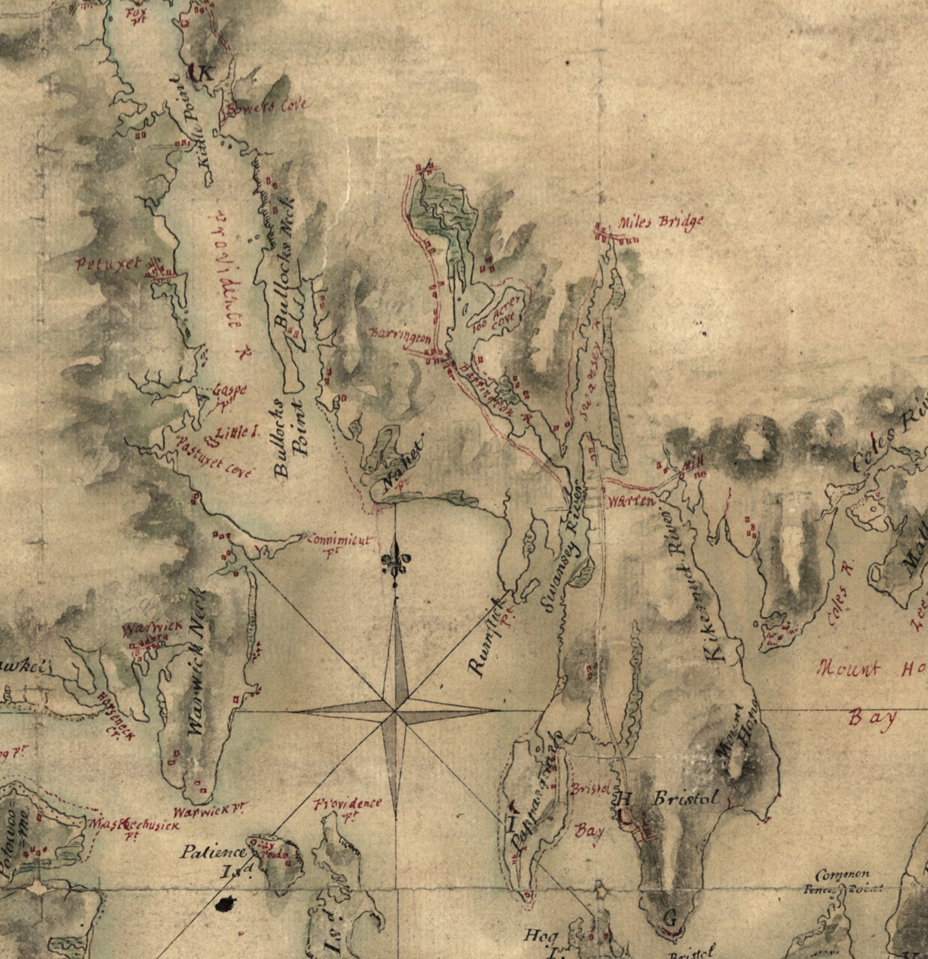 | Library of Congress |
| 1777 | “Topographical Chart of the Bay of Narraganset,” surveyed by Charles Blaskowitz, engraved by Faden, London. | 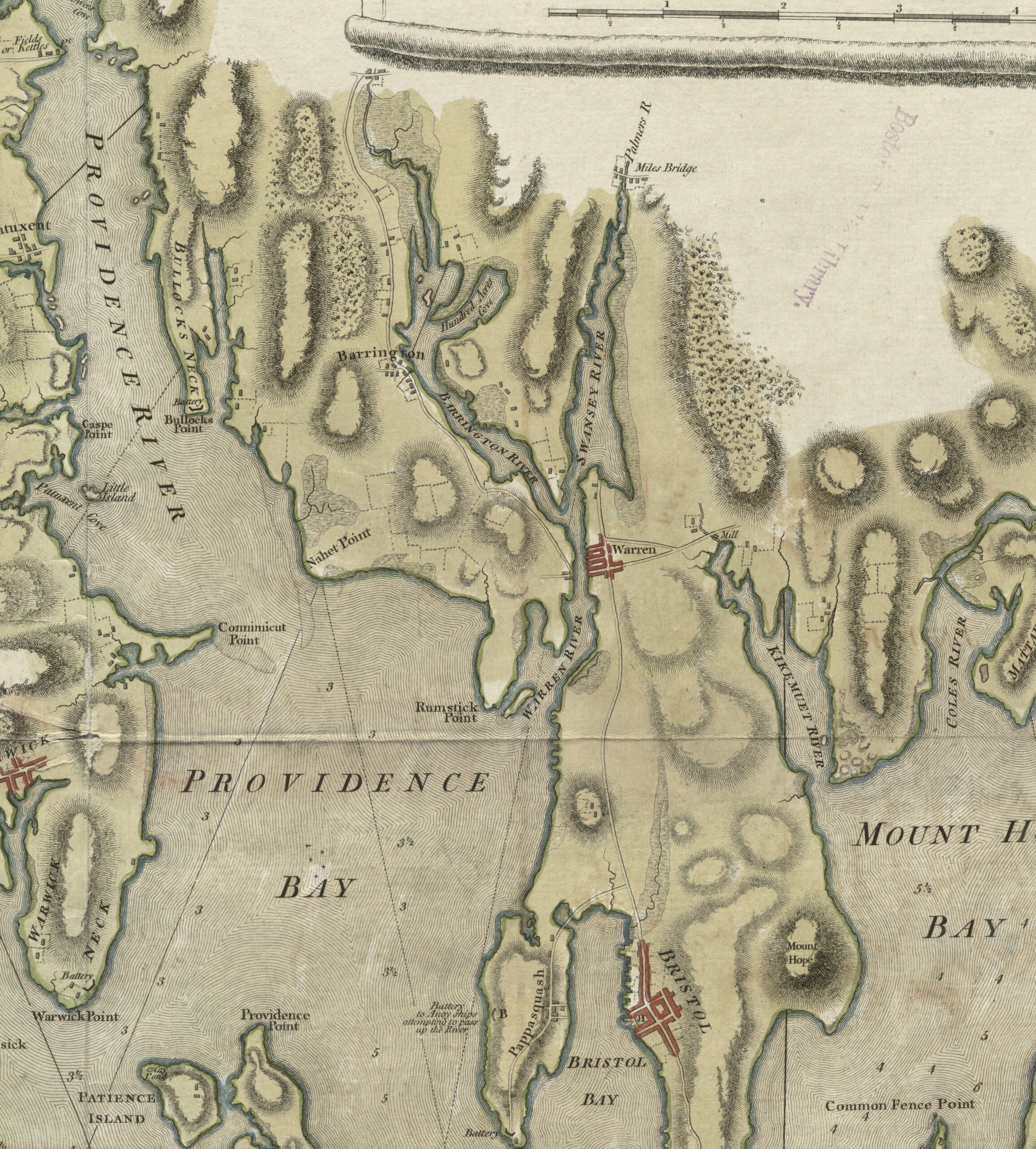 | Boston Public Library, Leventhal Map Center |
| 1781 | “Chart of the Harbour of Rhode Island and Narragansett Bay Published at the Request of the Right Honourable Lord Viscount Howe” by J. F. W. Des Barres. A later edition of the 1776 engraving (see above) with additional coastal details and soundings. | 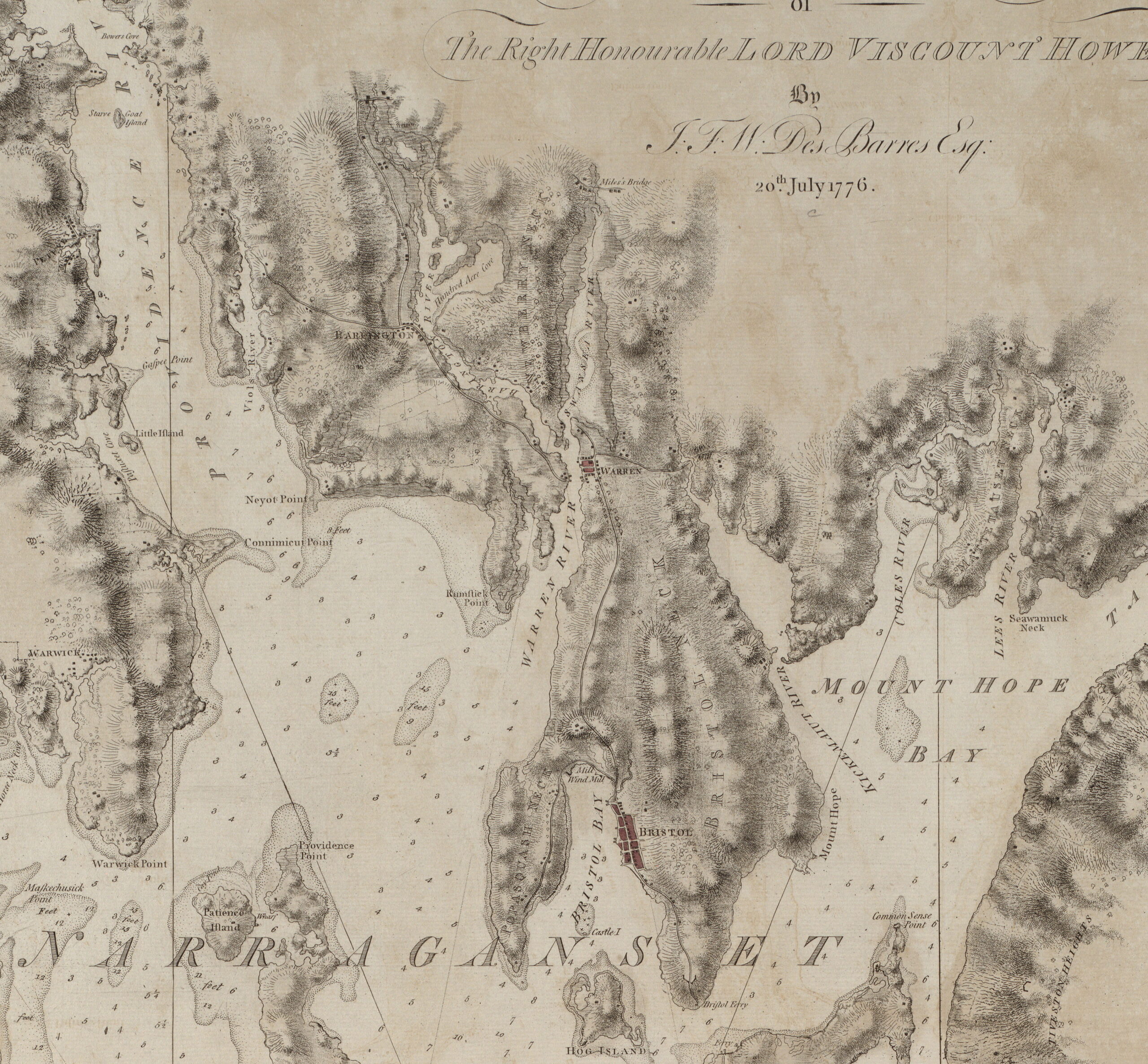 | Boston Public Library, Leventhal Map Center |
| 1797 | Plat of Federal Road, Barrington, showing Meeting House (White Church) and Joshua Bicknell house. Ink plat by Thomas Allin. |  | Photograph of original at B.P.S. (Barrington Town Records Collection) |
| 1851 | Walling sheet map of Bristol Co., R.I. | 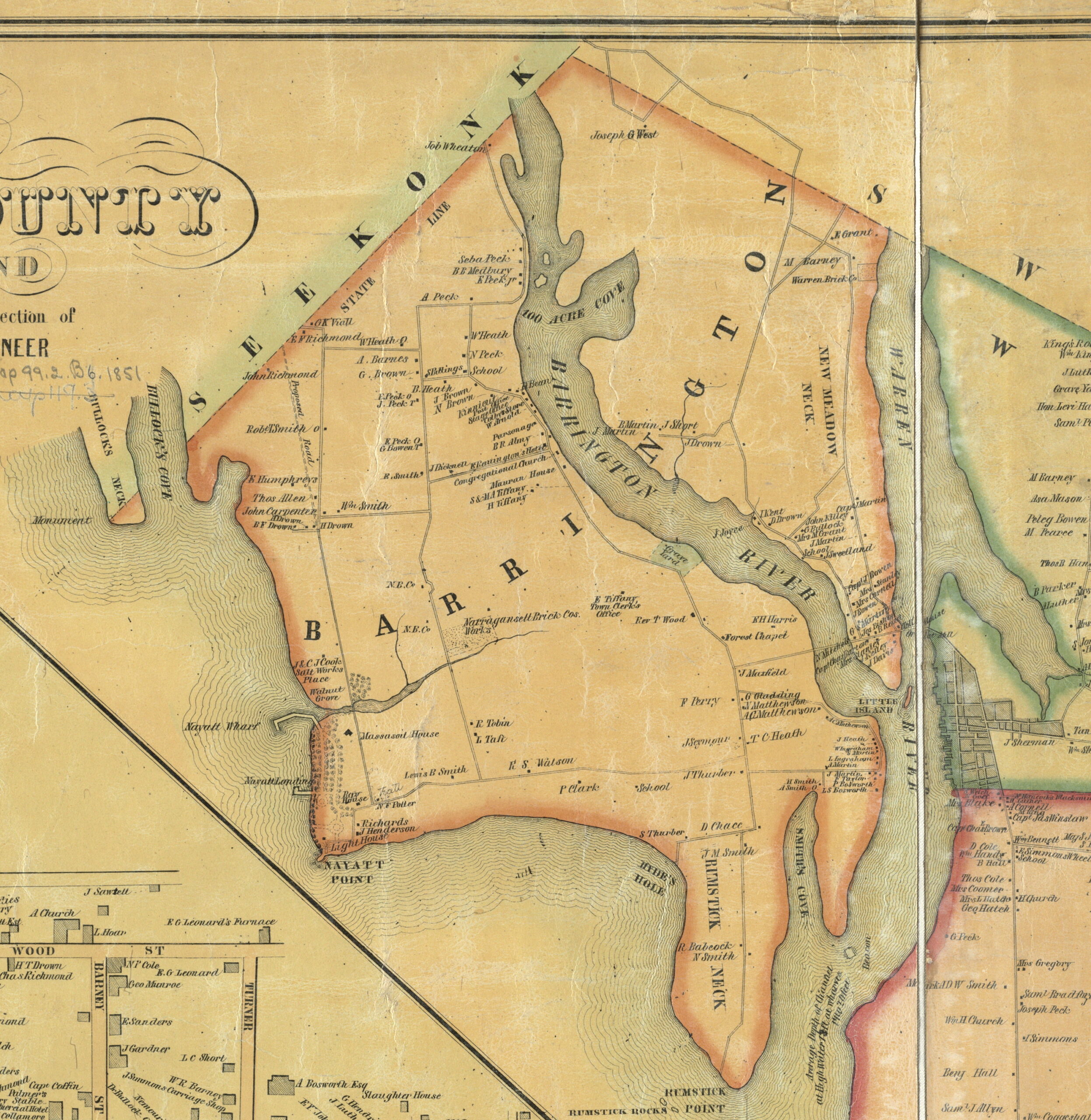 | Boston Public Library, Leventhal Map Center |
| 1851 | Walling sheet map of Providence Co., R.I. |  | Boston Public Library, Leventhal Map Center |
| 1855 | Walling sheet map of Rhode Island. | 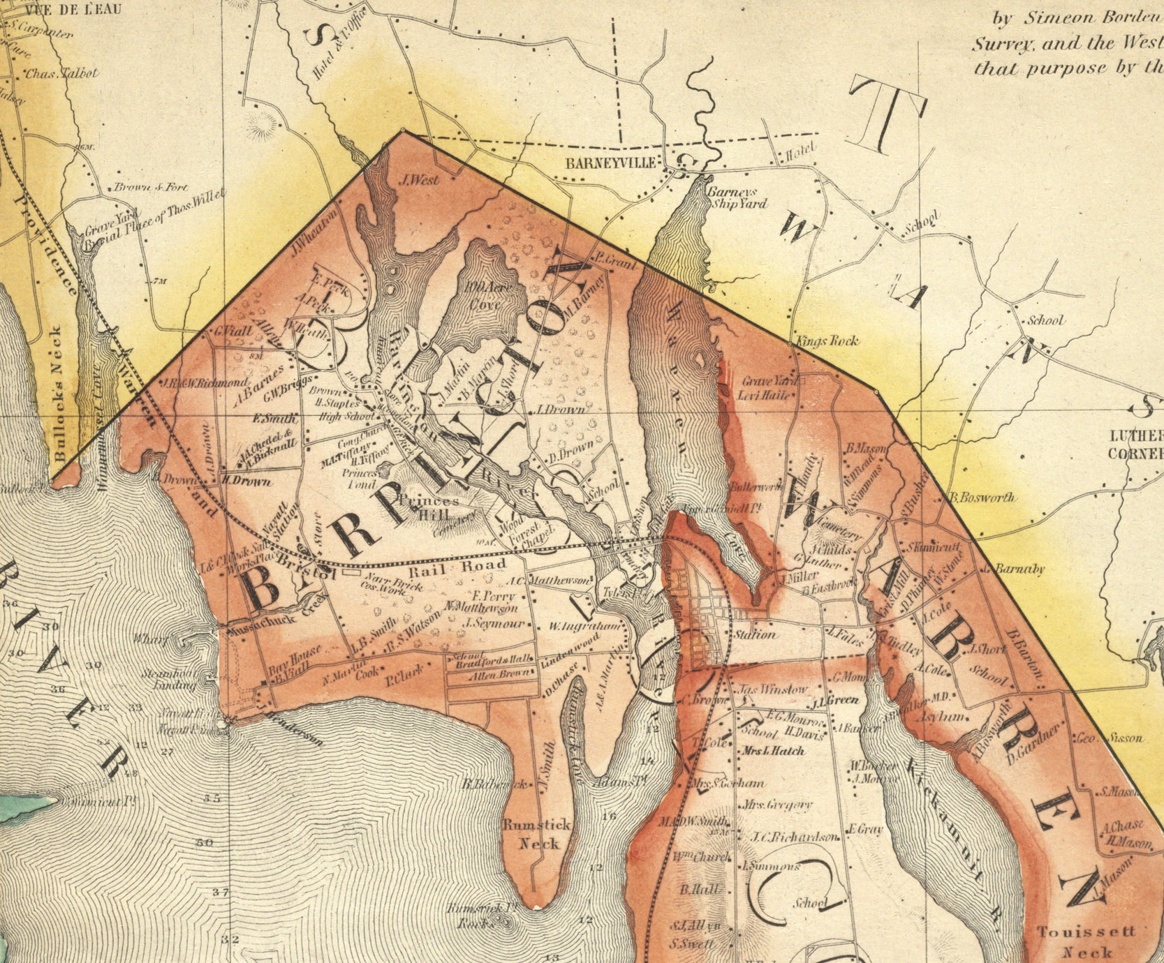 | Boston Public Library, Leventhal Map Center |
| 1862 | Walling sheet map of Rhode Island. | 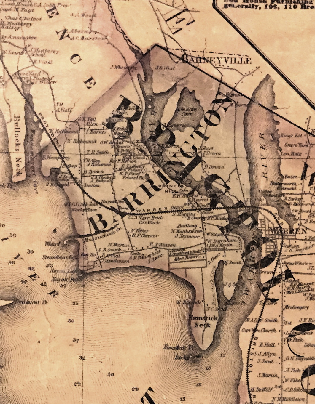 | Digital photo of original at BPS (low quality). |
| 1867 | Mason Survey (Barrington property map): Sheet Index. | 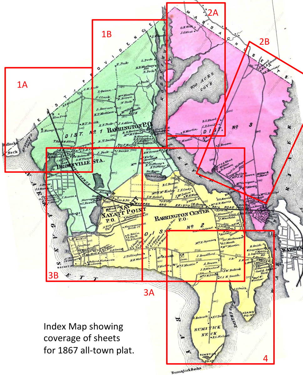 | |
| 1867 | Mason Survey sheet 1a | 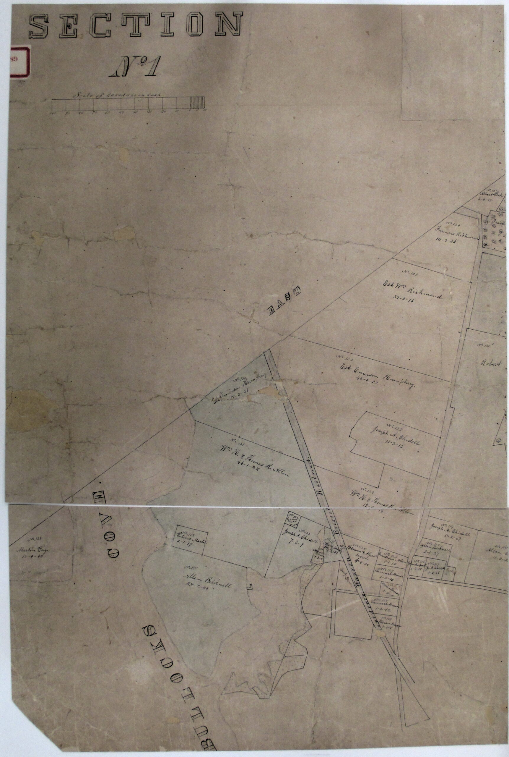 | Digital photo of original at Town Hall (low quality). |
| 1867 | Mason Survey sheet 1b | 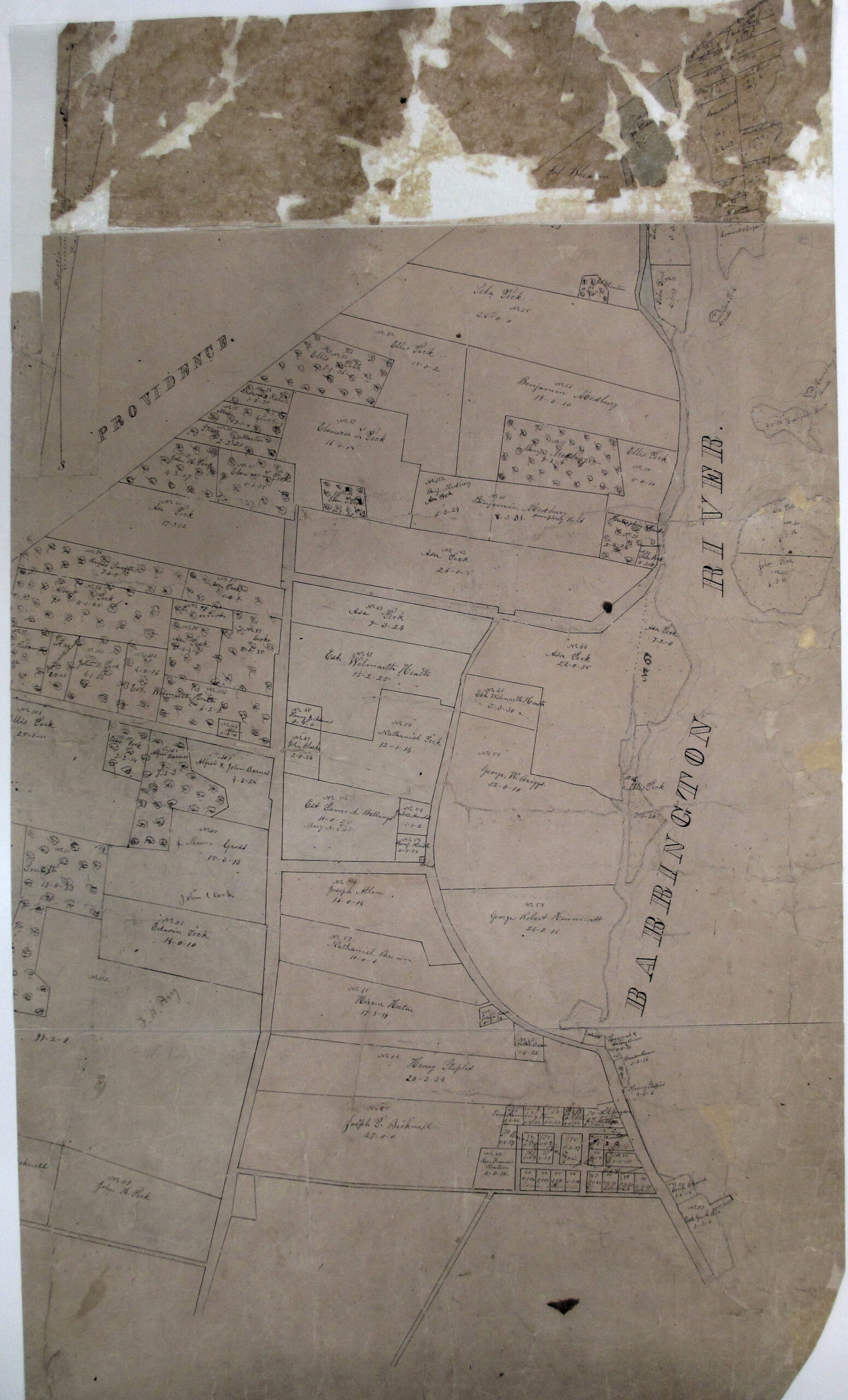 | Digital photo of original at Town Hall (low quality). |
| 1867 | Mason Survey sheet 2a | 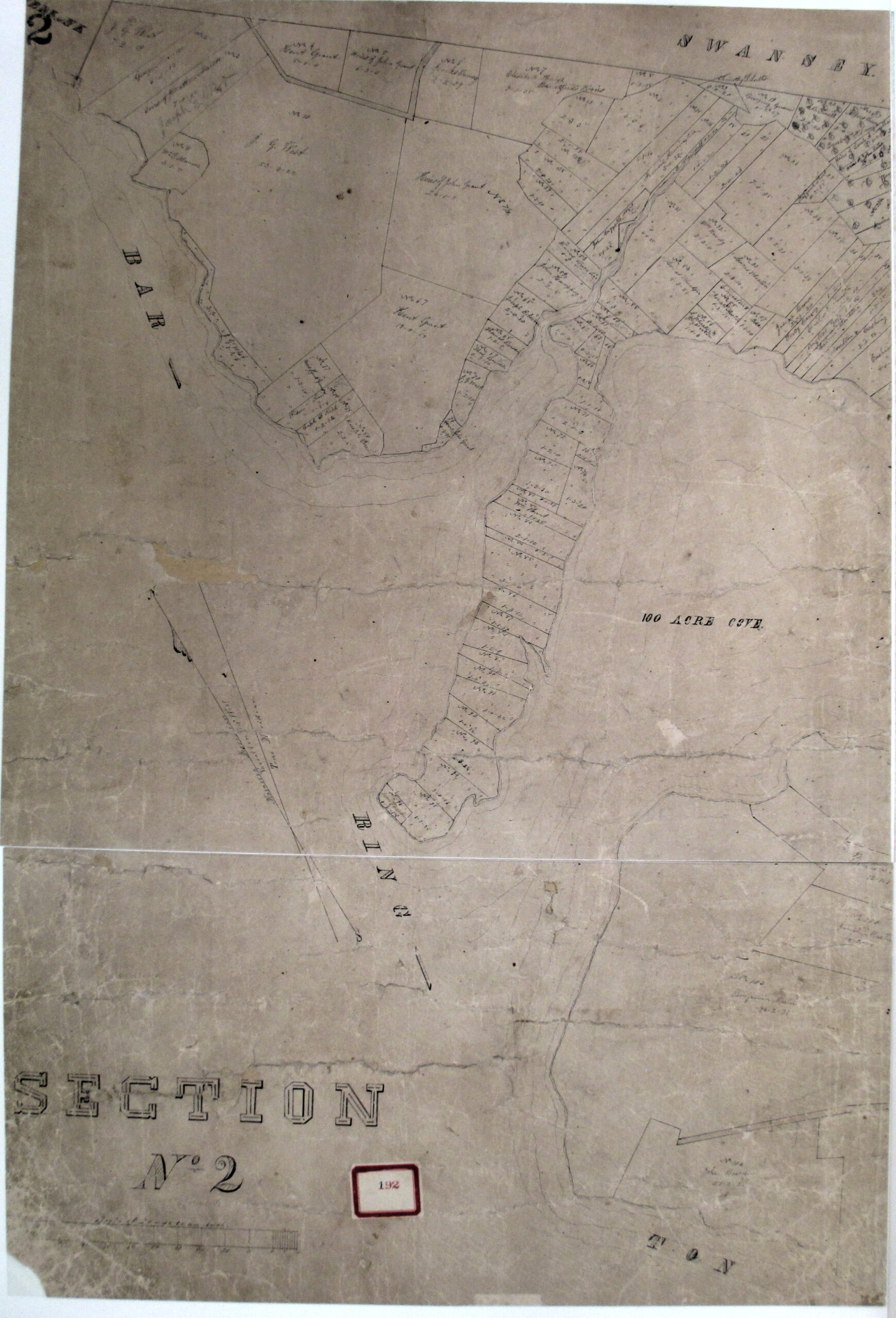 | Digital photo of original at Town Hall (low quality). |
| 1867 | Mason Survey sheet 2b | 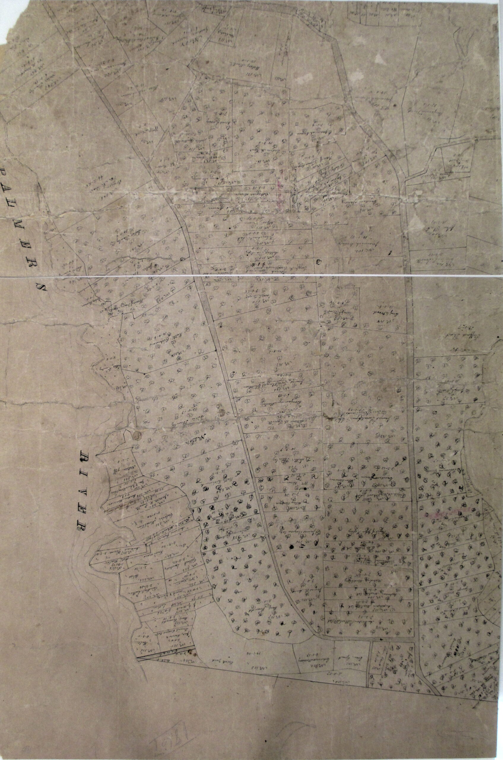 | Digital photo of original at Town Hall (low quality). |
| 1867 | Mason Survey sheet 3a |  | Digital photo of original at Town Hall (low quality). |
| 1867 | Mason Survey sheet 3b | 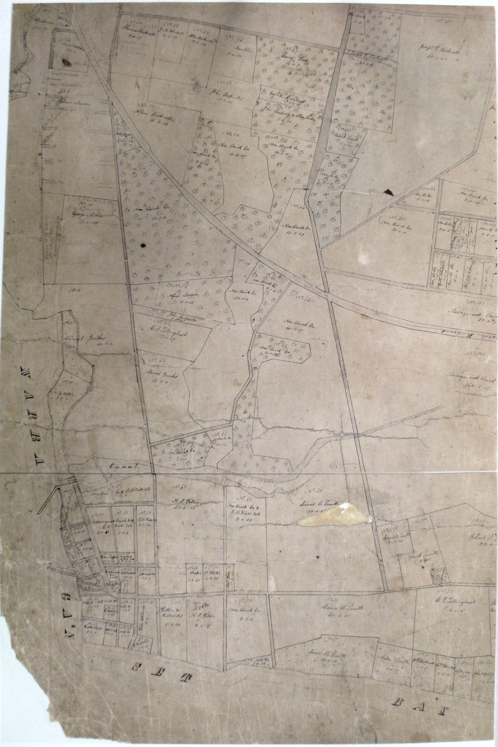 | Digital photo of original at Town Hall (low quality). |
| 1867 | Mason Survey sheet 4 | 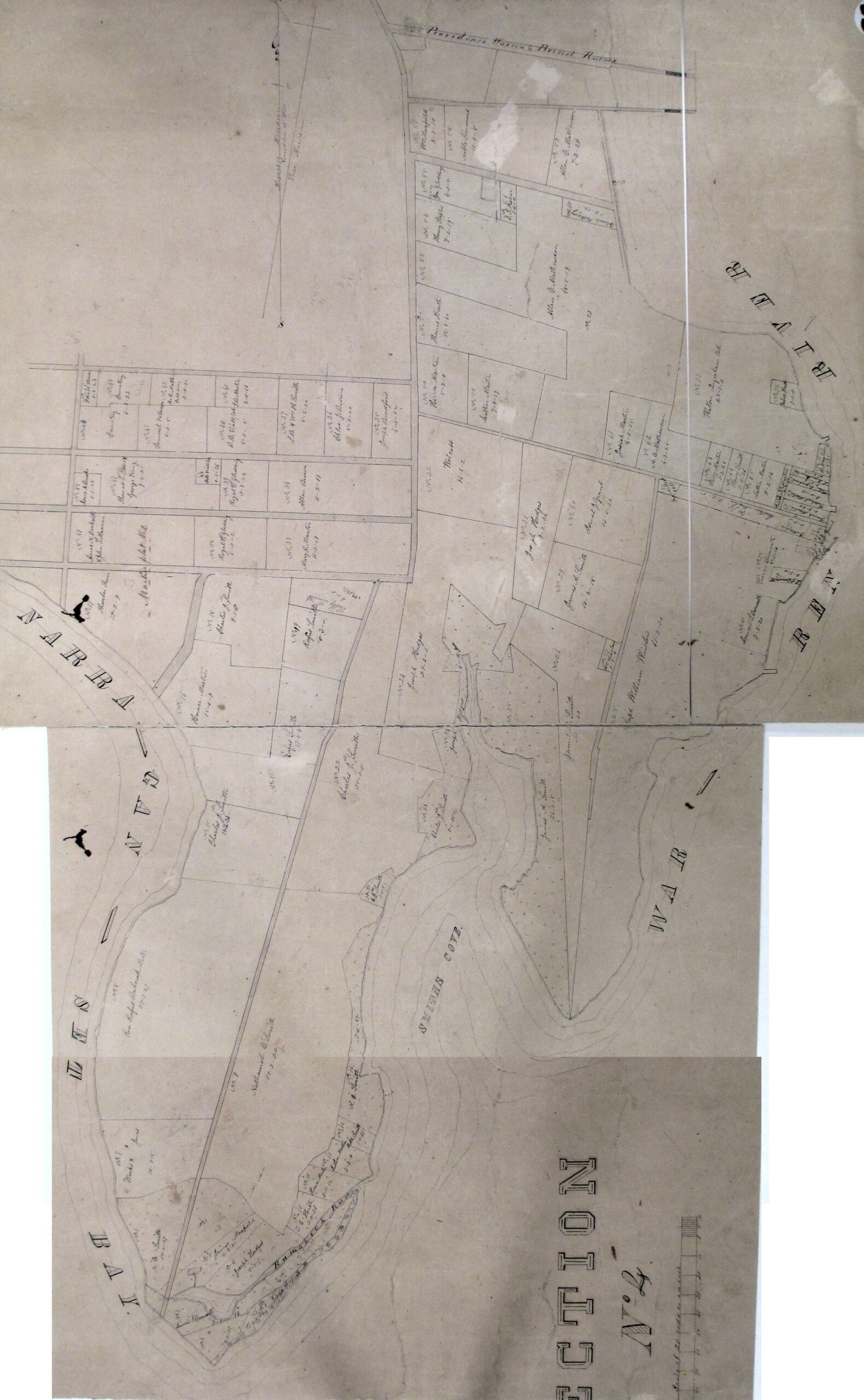 | Digital photo of original at Town Hall (low quality). |
| 1870 | Barrington: Beers Atlas map | 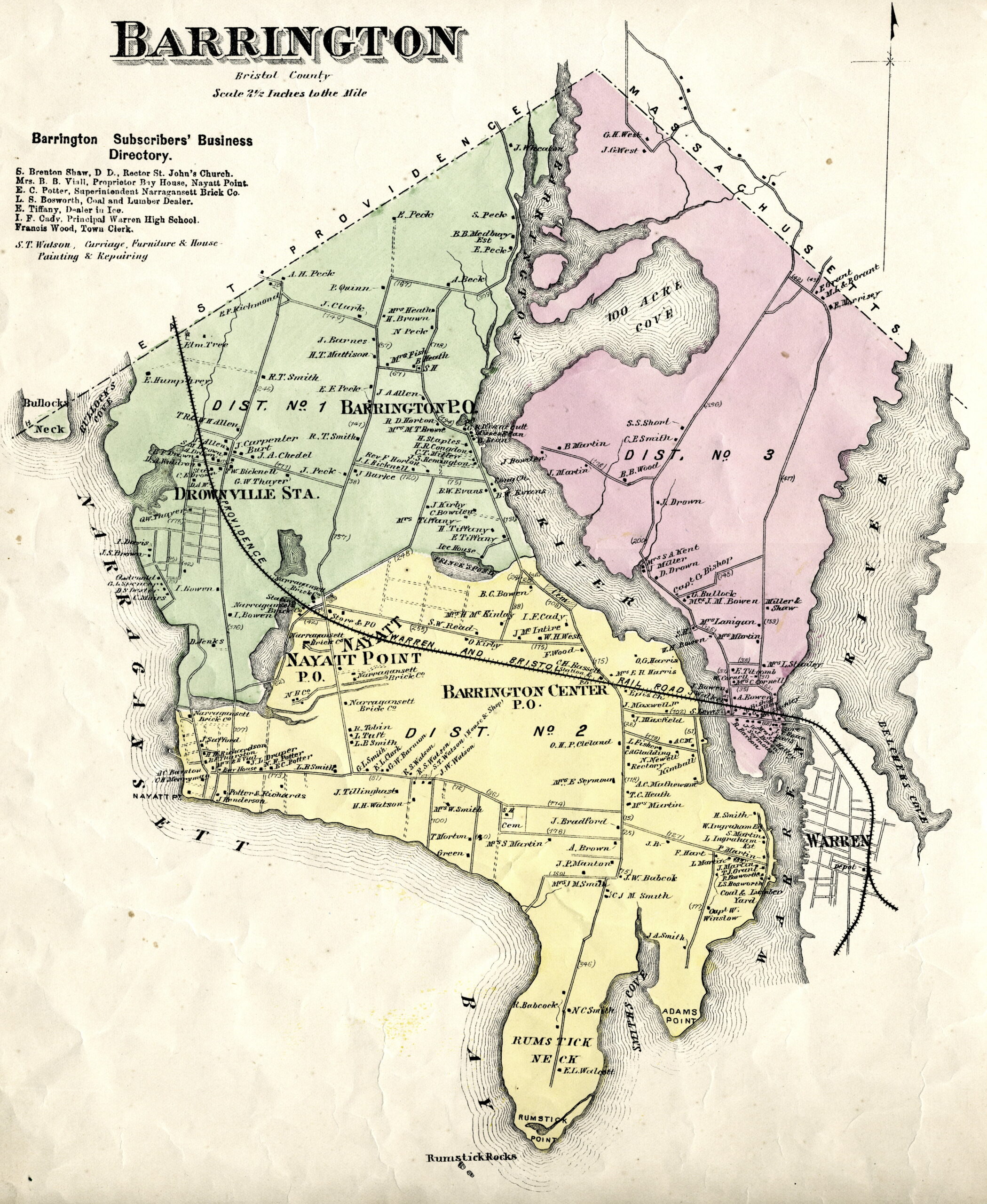 | Scan of original at BPS. |
| 1895 | Barrington: Everts and Richards Atlas map of Bristol Co. | 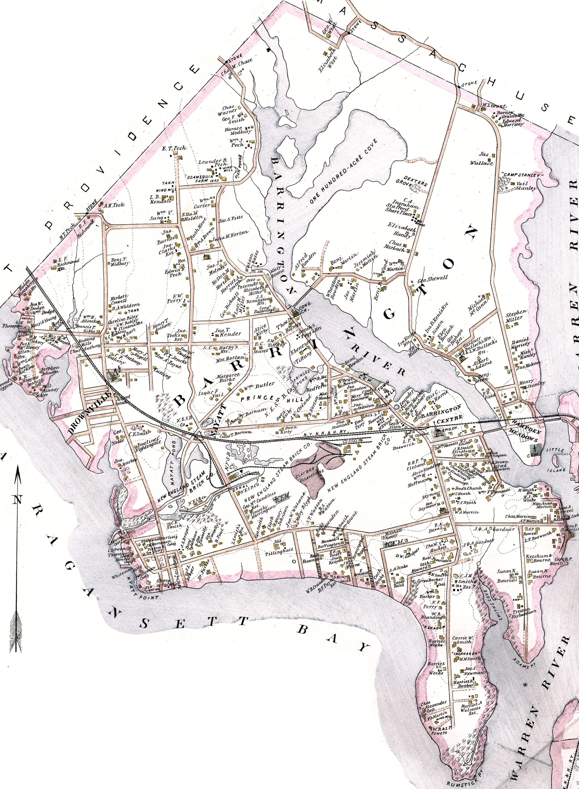 | Digital image licensed to BPS. |
| 1908 | “Map of Indian Localities about Narragansett and Mount Hope Bays by Thomas Bicknell,” drawn by E. W. Ross (from Bicknell, Sowams: With Ancient Records of Sowams and Parts Adjacent). | 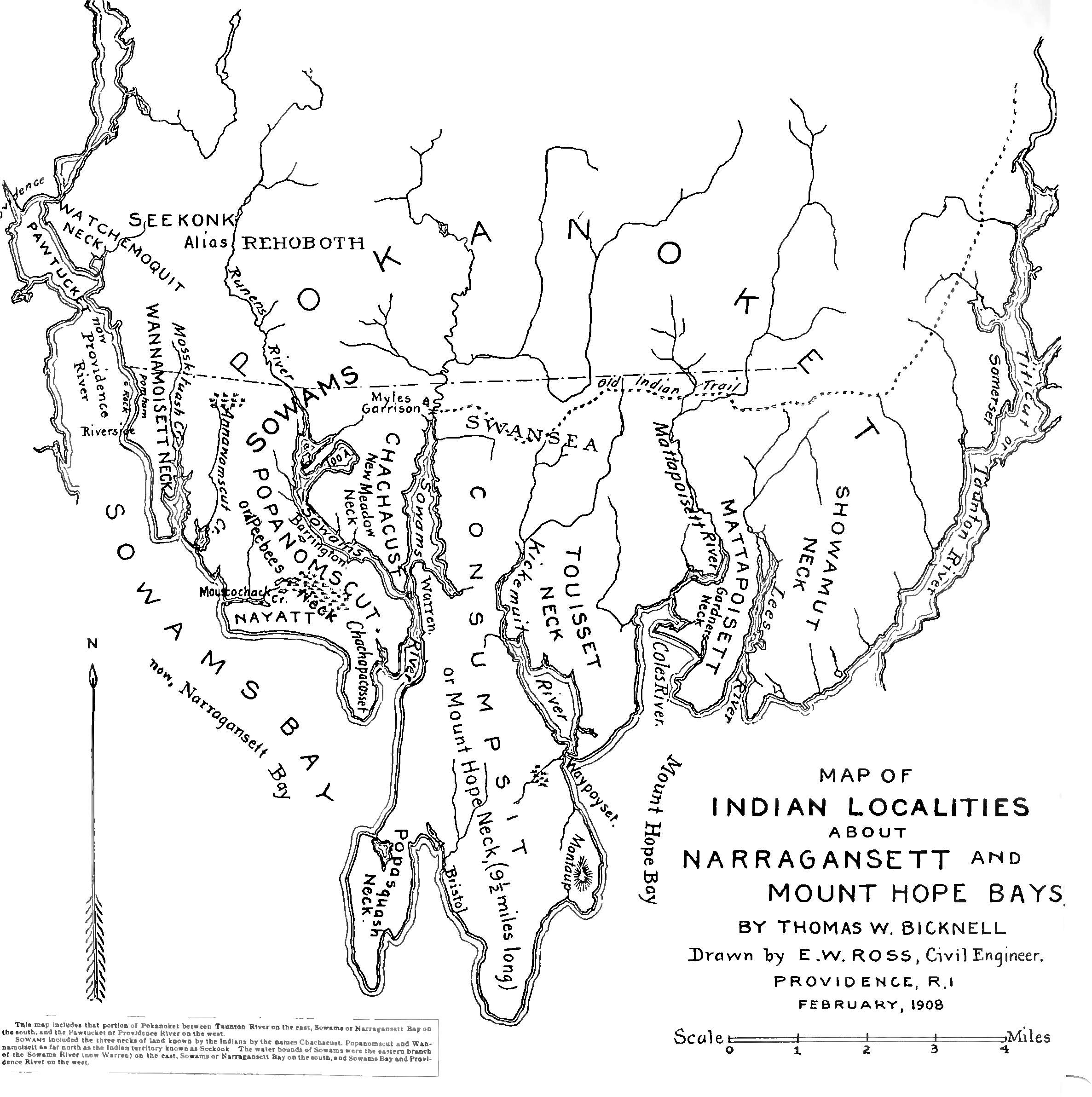 | Scan of original at BPS. |
| 1921 | Sanborn Atlas of Barrington: Sheet Index [only parts of town are detailed] | 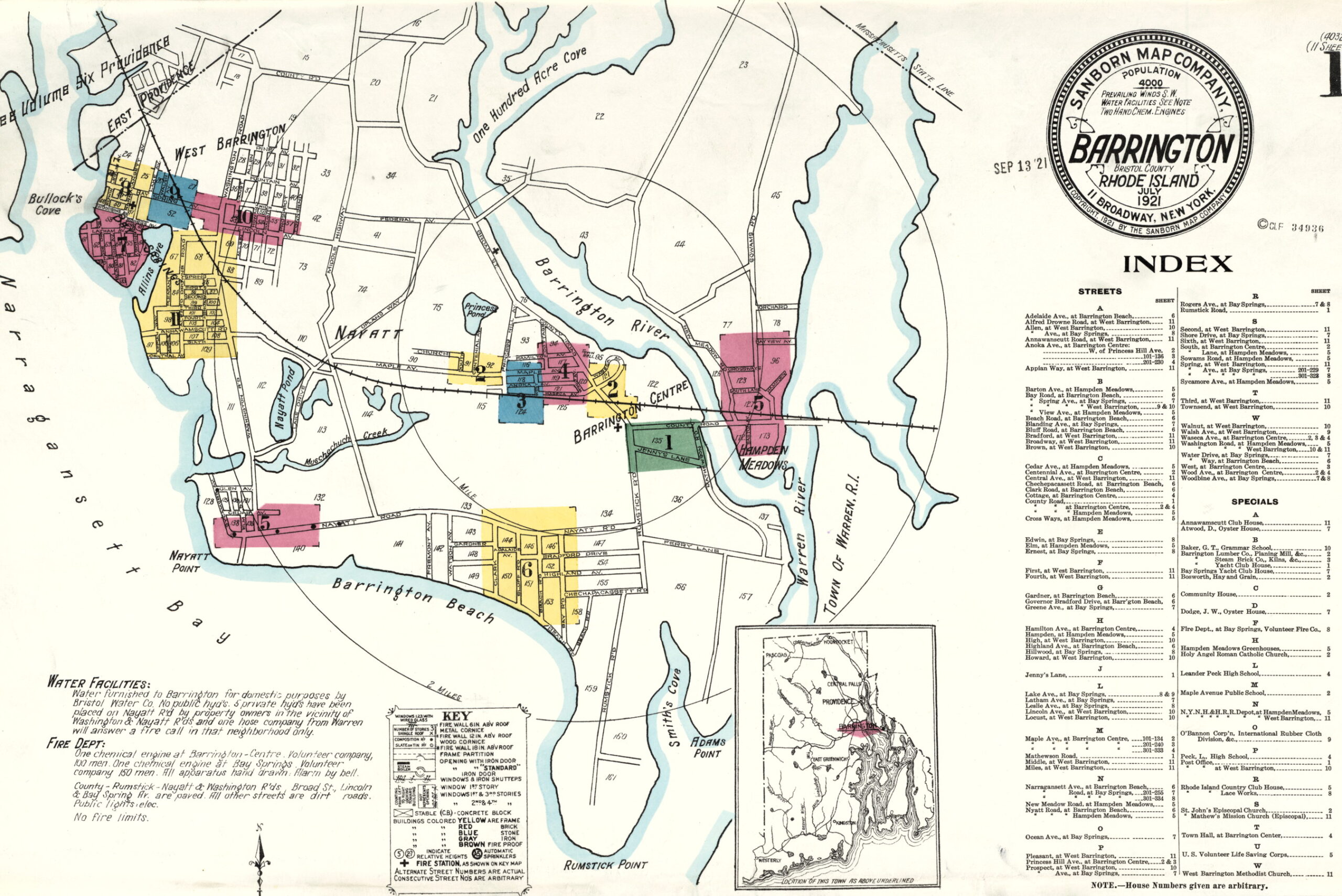 | Brown University Library Digital Collections |
| 1921 | Sanborn Atlas of Barrington: p. 1: Jennys Lane | 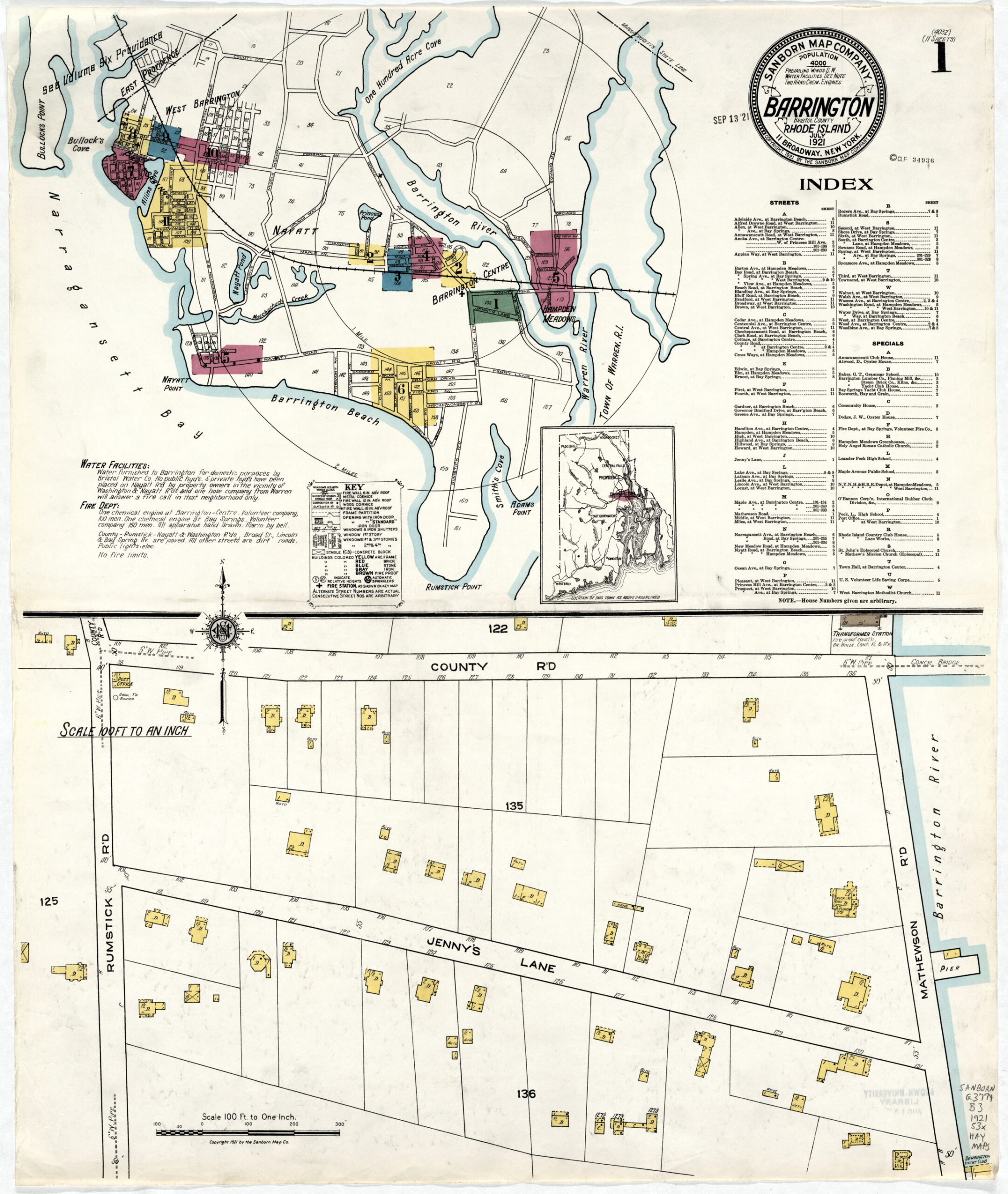 | Brown University Library Digital Collections |
| 1921 | Sanborn Atlas of Barrington: p. 2: Town Center | 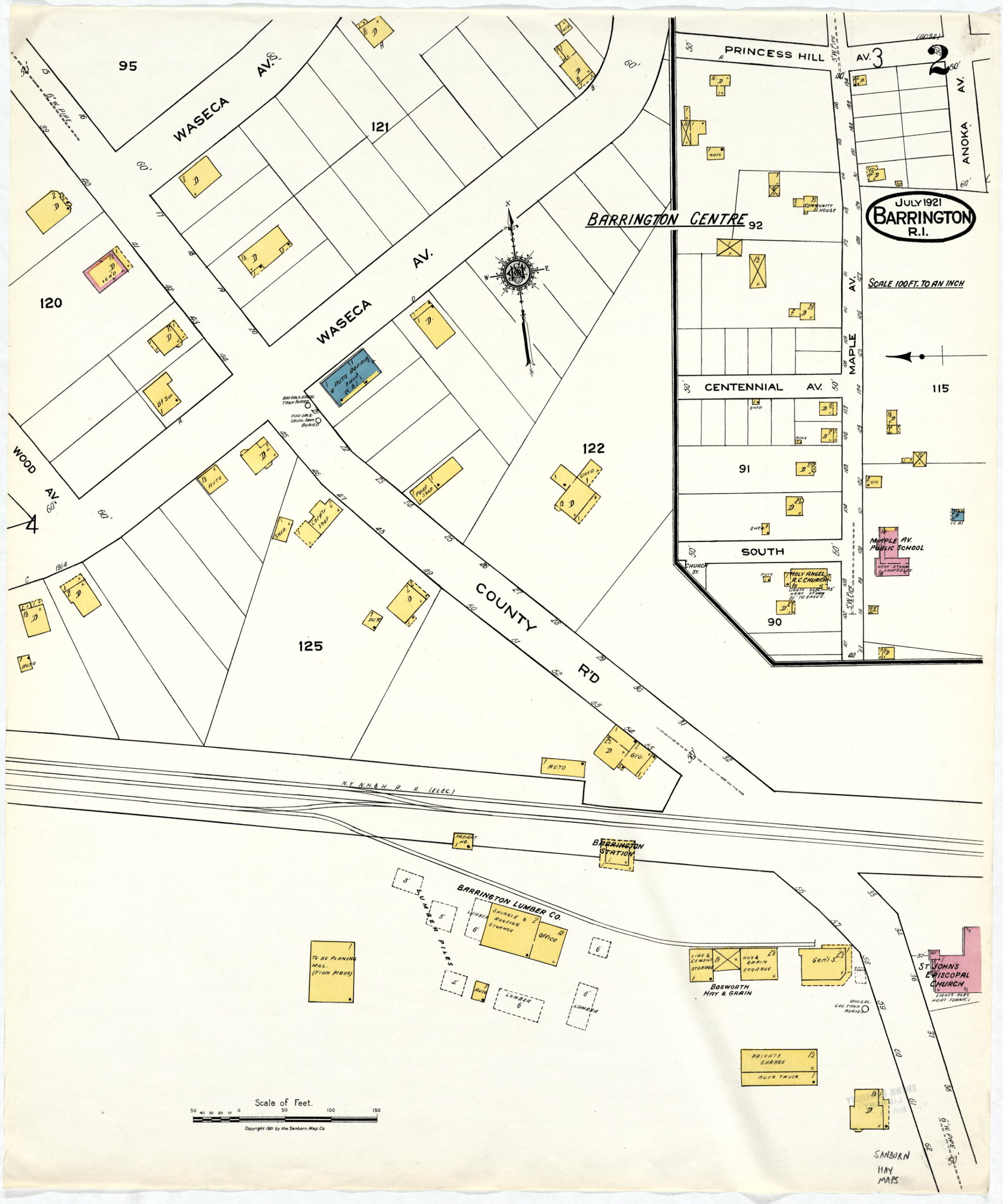 | Brown University Library Digital Collections |
| 1921 | Sanborn Atlas of Barrington: p. 3: Maple Ave. and Brickyard | 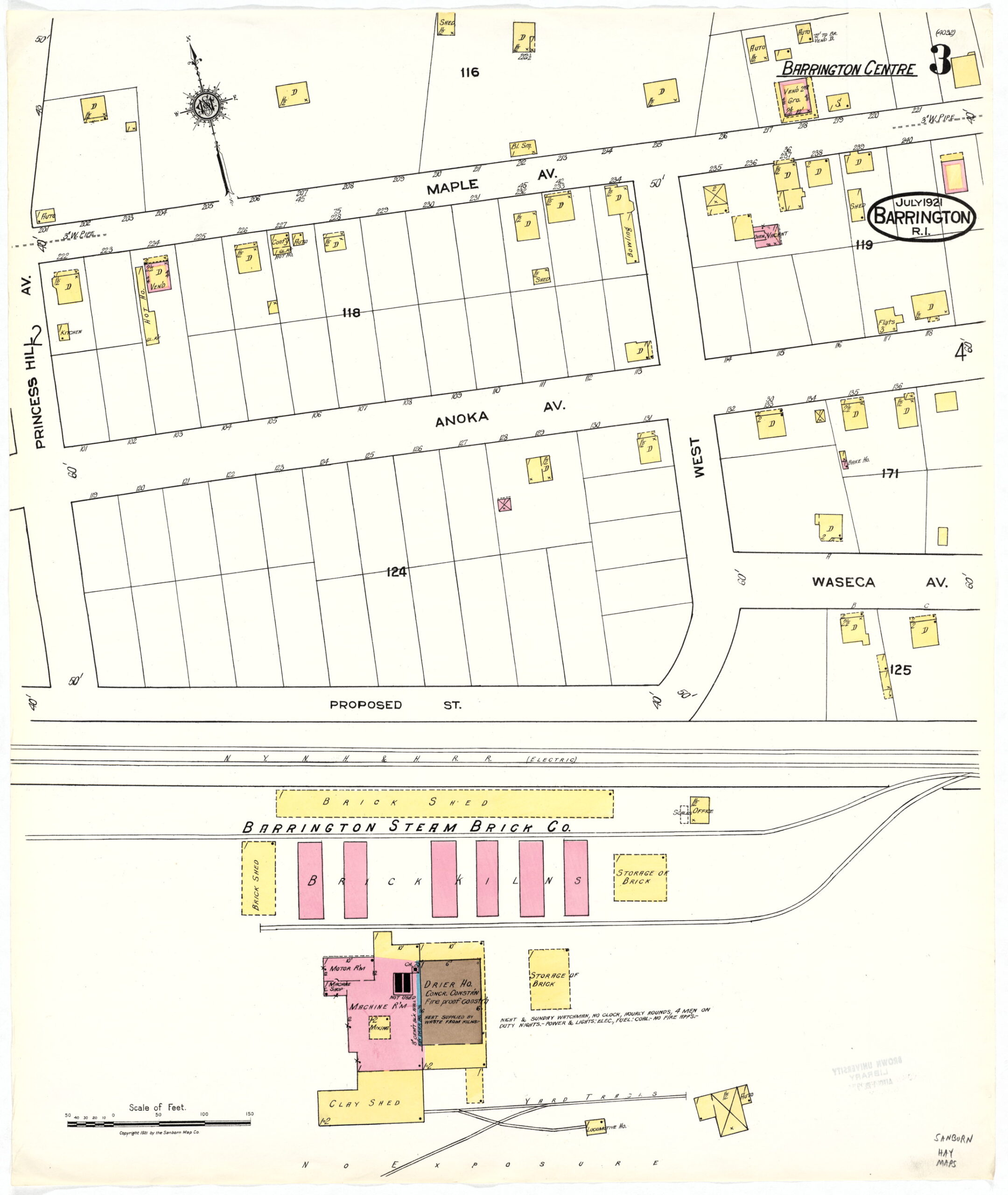 | Brown University Library Digital Collections |
| 1921 | Sanborn Atlas of Barrington: p. 4: Maple Ave., Anoka, Waseca | 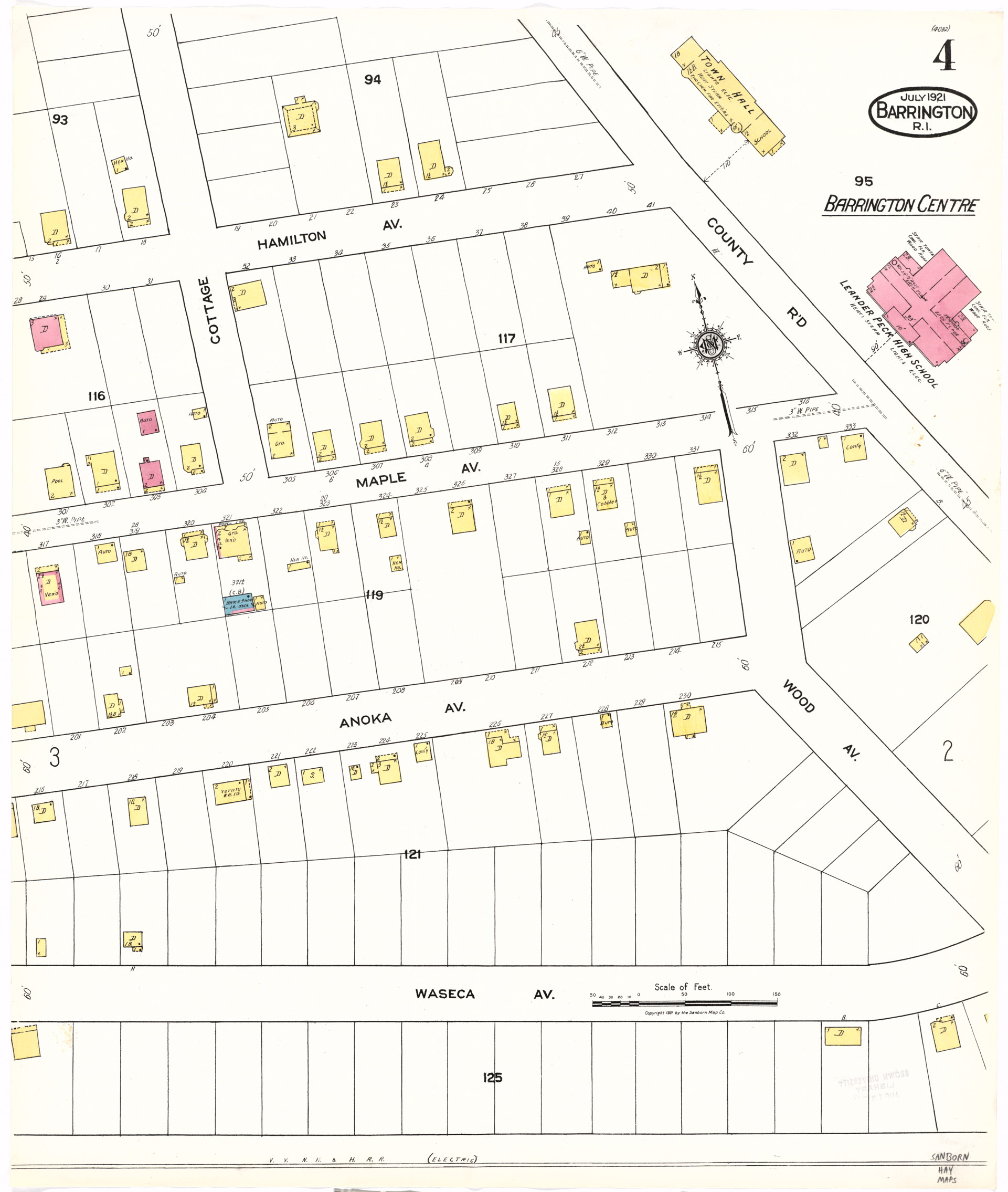 | Brown University Library Digital Collections |
| 1921 | Sanborn Atlas of Barrington: p. 5: Nayatt and Hampden Meadows | 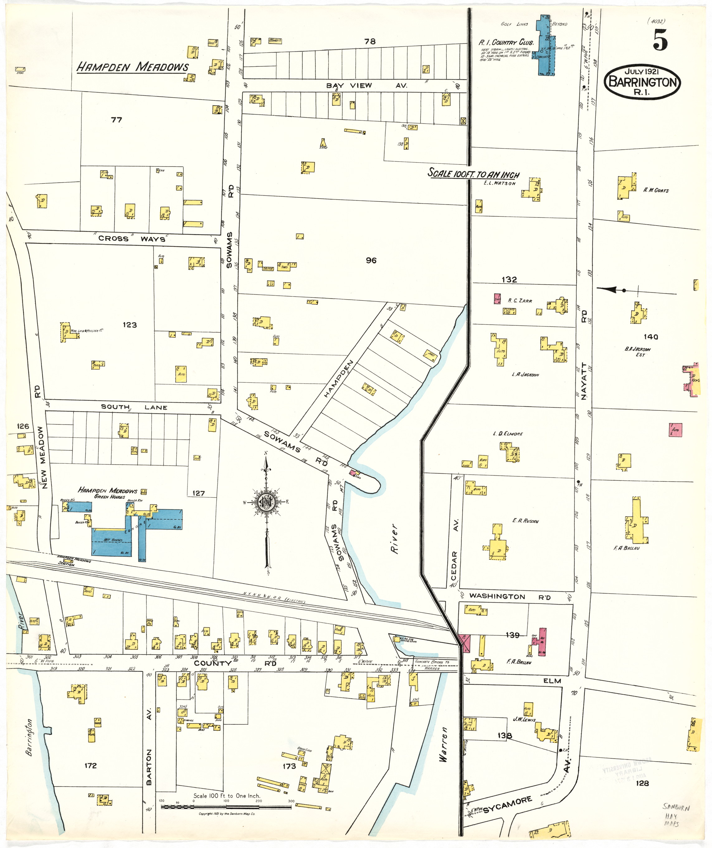 | Brown University Library Digital Collections |
| 1921 | Sanborn Atlas of Barrington: p. 6: by the town beach |  | Brown University Library Digital Collections |
| 1921 | Sanborn Atlas of Barrington: p. 7: Latham Point | 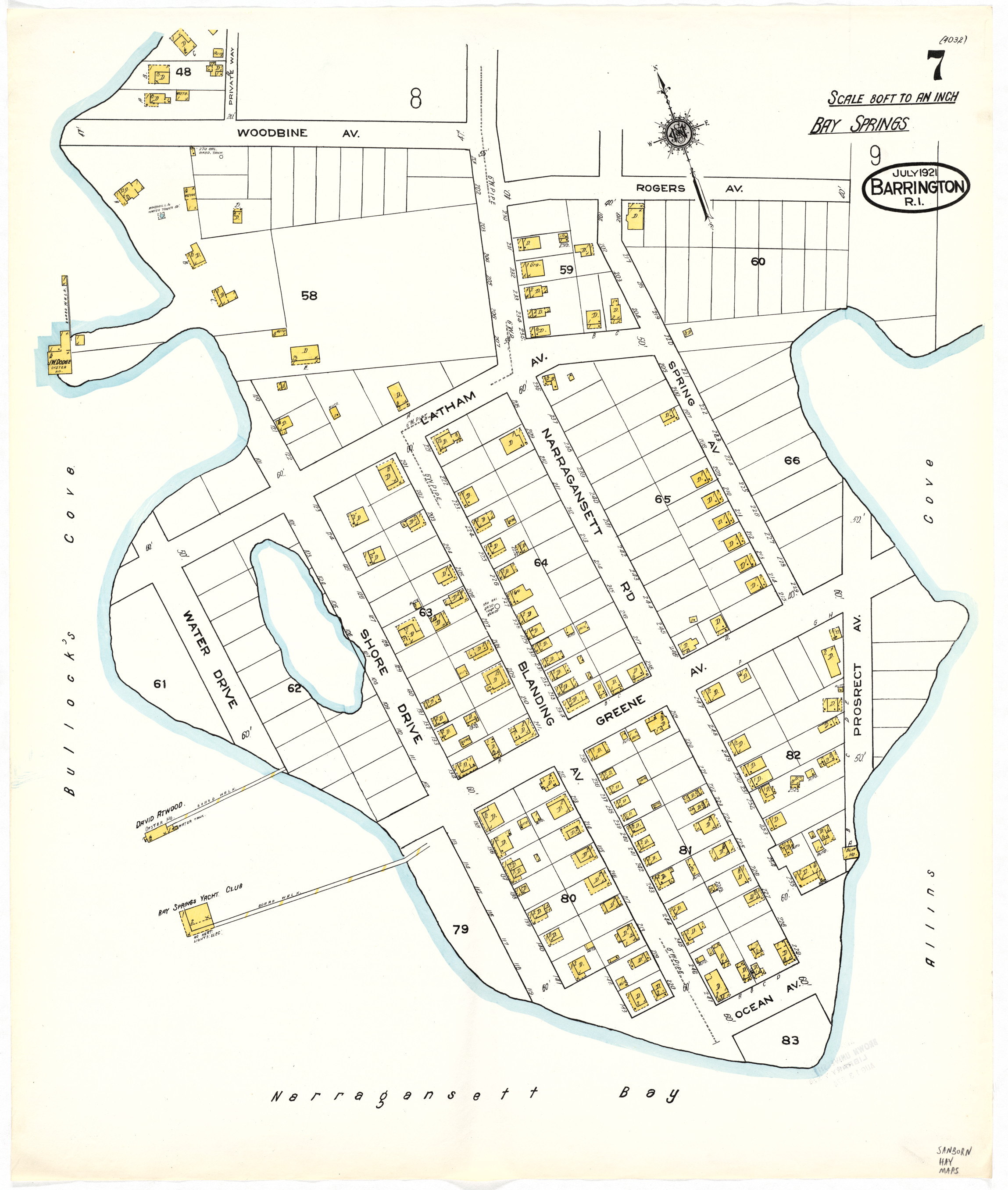 | Brown University Library Digital Collections |
| 1921 | Sanborn Atlas of Barrington: p. 8: Bay Spring and Narragansett Ave. | 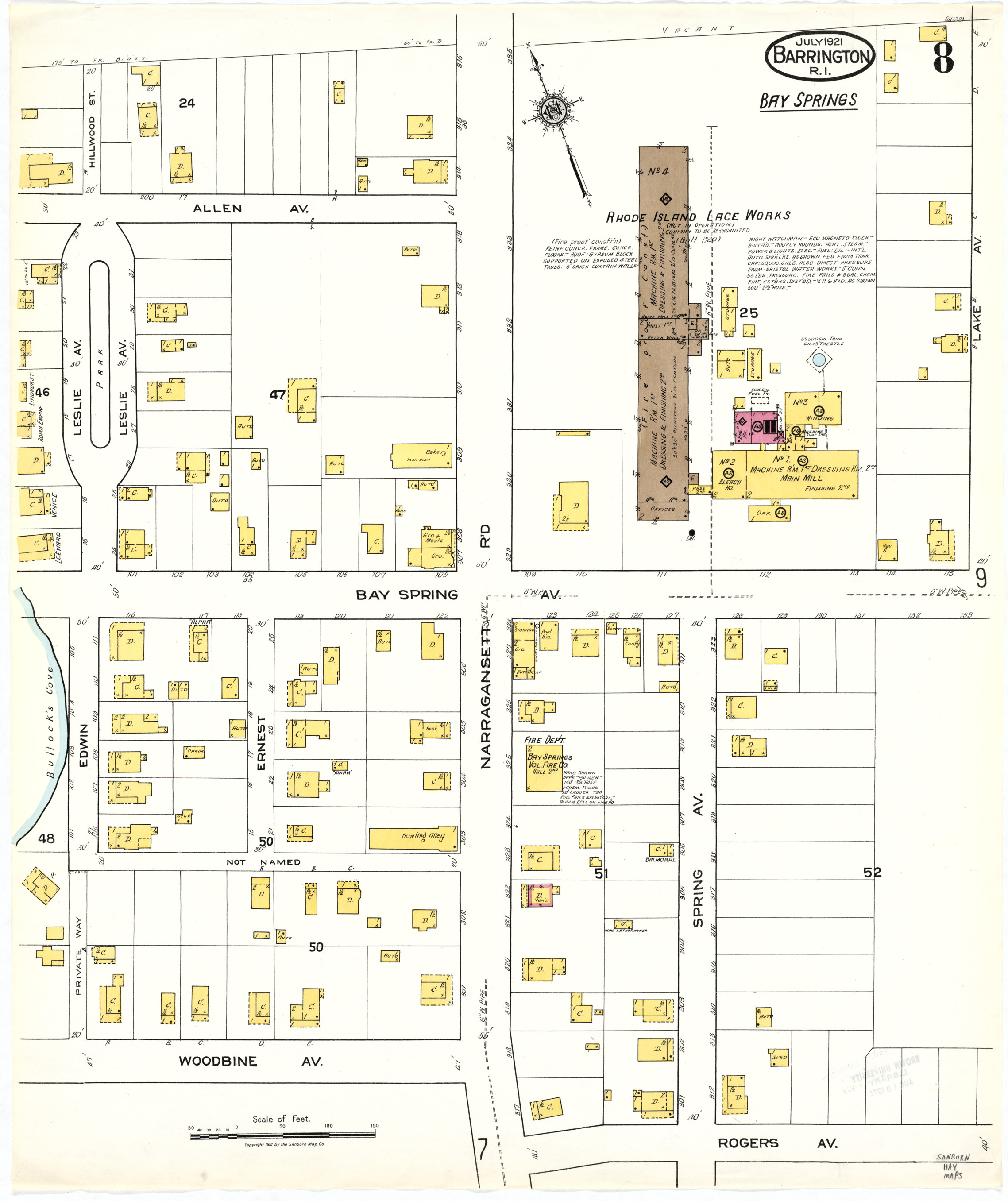 | Brown University Library Digital Collections |
| 1921 | Sanborn Atlas of Barrington: p. 9: Bay Spring: O Bannon Mill |  | Brown University Library Digital Collections |
| 1921 | Sanborn Atlas of Barrington: p. 10: Bay Spring, Washington, Lincoln | 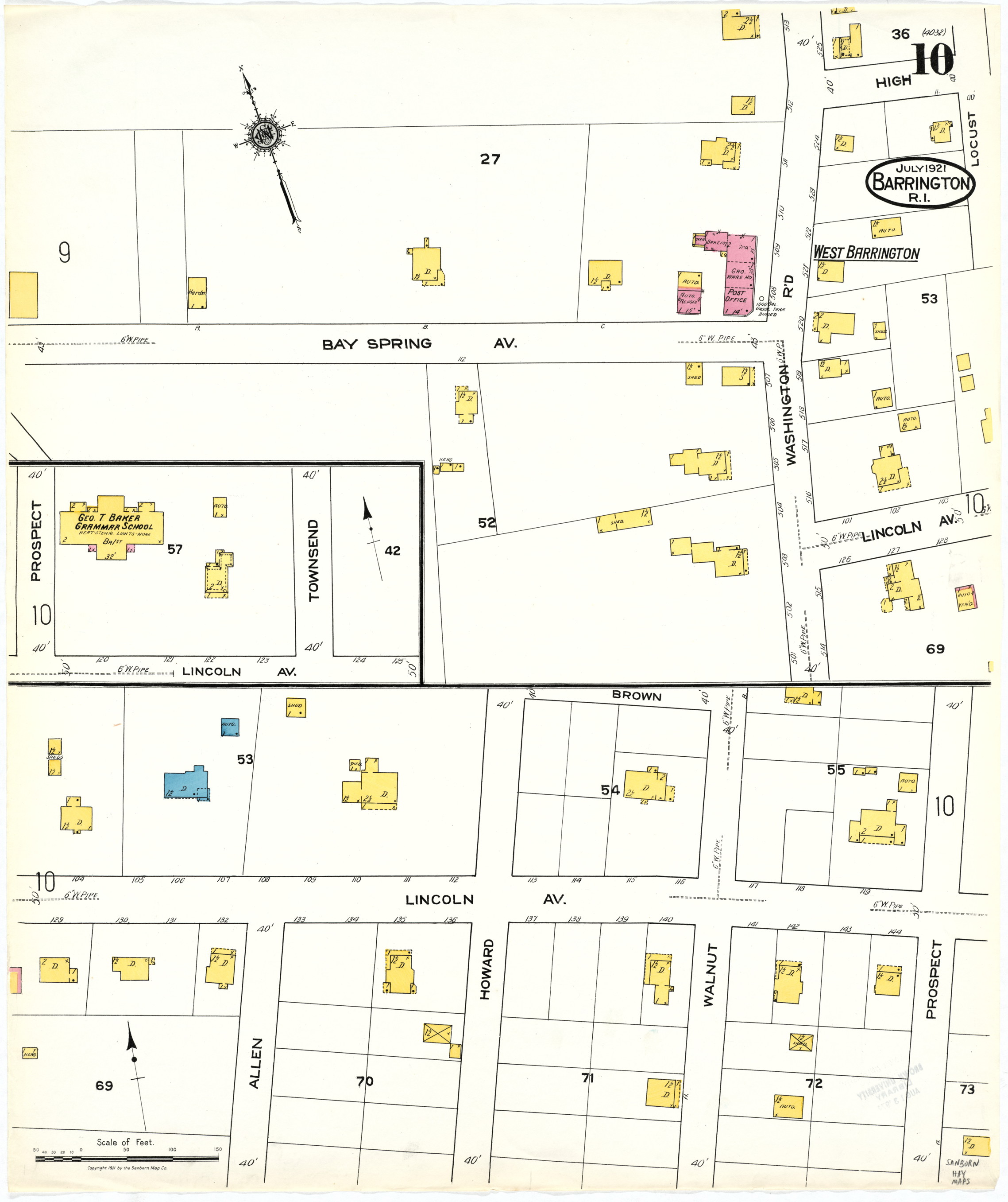 | Brown University Library Digital Collections |
| 1921 | Sanborn Atlas of Barrington: p. 11: Drownville | 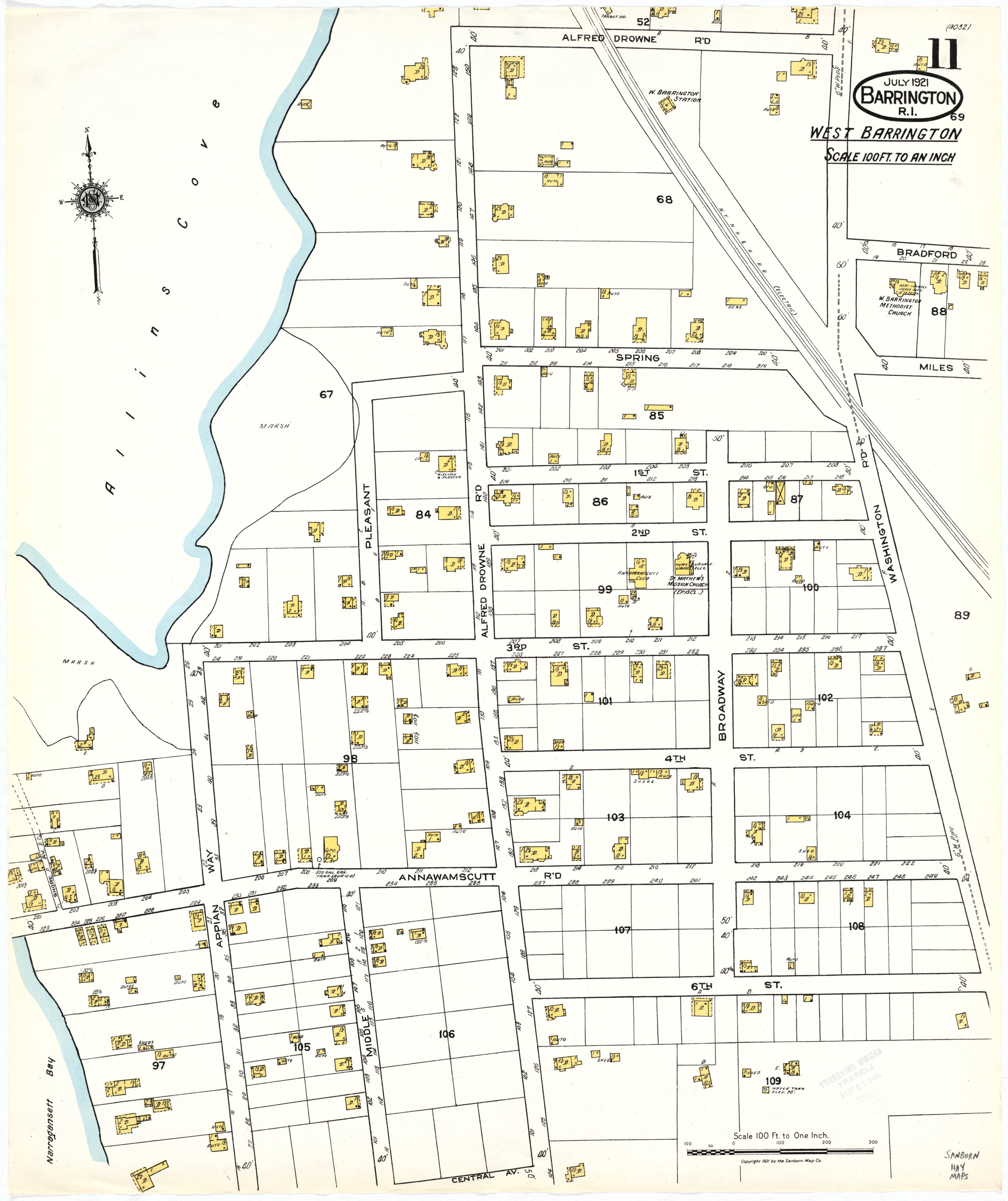 | Brown University Library Digital Collections |
| 1949 | USGS Grid maps: Barrington [parts of two sheets: north part is 1949, south part is 1943] | 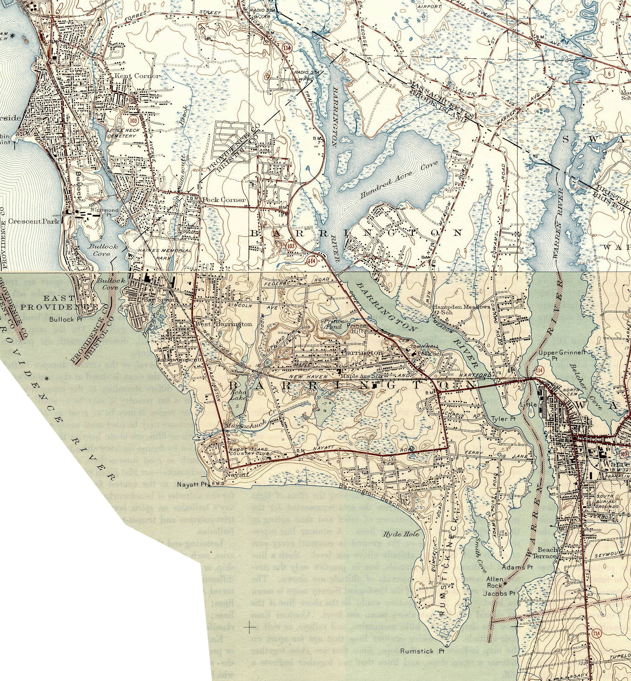 | Formerly at University of New Hampshire Historical USGS Maps Depository (offline 2022); now see map archive at the USGS |